Talegaon Dhamdhere
| Talegaon Dhamdhere | |
|---|---|
| village | |
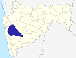
 Talegaon Dhamdhere Location in Maharashtra, India  Talegaon Dhamdhere Talegaon Dhamdhere (India) | |
| Coordinates: 18°40′04″N 074°09′13″E / 18.66778°N 74.15361°ECoordinates: 18°40′04″N 074°09′13″E / 18.66778°N 74.15361°E | |
| Country |
|
| State | Maharashtra |
| District | Pune |
| Taluka | Shirur |
| Population (2001) | |
| • Total | 13,410 |
| Languages | |
| • Official | Marathi |
| Time zone | UTC+5:30 (IST) |
| PIN | 412208 |
Talegaon Dhamdhere is a panchayat village[1] in the state of Maharashtra, India,[2][3] on the right (south) bank of the Vel River (Wel River).[4] Administratively, Talegaon Dhamdhere is under Shirur Taluka of Pune District in Maharashtra.[3] There is only the single village of Talegaon Dhamdhere in the Talegaon Dhamdhere gram panchayat.[3] The village of Talegaon Dhamdhere is 4 km by road southeast of the village of Shikrapur, and 6 km by road north of the village of Vittalwadi.
Demographics
In the 2001 census, the village of Talegaon Dhamdhere had 13,410 inhabitants, with 6,912 males (51.5%) and 6,498 females (48.5%), for a gender ratio of 940 females per thousand males.[5]
Notes
- ↑ 2011 Village Panchayat Code for Talegaon Dhamdhere = 188626, "Reports of National Panchayat Directory: Village Panchayat Names of Shirur, Pune, Maharashtra". Ministry of Panchayati Raj, Government of India. Archived from the original on 2013-05-11.
- ↑ 2001 Census Village code for Talegaon Dhamdhere = 03050500, "2001 Census of India: List of Villages by Tehsil: Maharashtra" (PDF). Registrar General & Census Commissioner, India. p. 592. Archived (PDF) from the original on 13 November 2011.
- 1 2 3 2011 Census Village code for Talegaon Dhamdhere = 555634, "Reports of National Panchayat Directory: List of Census Villages mapped for: Talegaon Dhamdhere Gram Panchayat, Shirur, Pune, Maharashtra". Ministry of Panchayati Raj, Government of India. Archived from the original on 2013-05-11.
- ↑ Poona India, Sheet NE 43-06 (topographic map, scale 1:250,000), Series U-502, United States Army Map Service, May 1960
- ↑ "Census 2001 Population Finder: Maharashtra: Pune: Shirur: Talegaon Dhamdhere". Office of The Registrar General & Census Commissioner, Ministry of Home Affairs, Government of India.
External links
- "Official Website of Pune District".
- "Delimitation of PC and AC - 2004 Shirur Taluka, Pune District, Maharashtra (Administrative Units)". Pune District. Archived from the original (Map) on 2012-03-07.
Pune district topics | ||||||||||||||||||
|---|---|---|---|---|---|---|---|---|---|---|---|---|---|---|---|---|---|---|
| History |
| |||||||||||||||||
| Geography |
| |||||||||||||||||
| Cities and towns |
| |||||||||||||||||
| Transport | ||||||||||||||||||
| Culture | ||||||||||||||||||
| Constituencies |
| |||||||||||||||||
This article is issued from
Wikipedia.
The text is licensed under Creative Commons - Attribution - Sharealike.
Additional terms may apply for the media files.