Tát
| Tát Taath (in German) | ||
|---|---|---|
| Town | ||
| ||
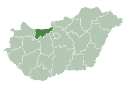
 Tát Location of Tát | ||
| Coordinates: 47°44′26″N 18°38′41″E / 47.74066°N 18.64471°ECoordinates: 47°44′26″N 18°38′41″E / 47.74066°N 18.64471°E | ||
| Country |
| |
| County | Komárom-Esztergom | |
| District | Esztergom | |
| Area | ||
| • Total | 11.78 km2 (4.55 sq mi) | |
| Population (2015)[1] | ||
| • Total | 5,280 | |
| • Density | 450/km2 (1,200/sq mi) | |
| Time zone | UTC+1 (CET) | |
| • Summer (DST) | UTC+2 (CEST) | |
| Postal code | 2534 | |
| Area code | (+36) 33 | |
| Website |
tat | |

Tát (German: Taath) is a town in Komárom-Esztergom county, Hungary.
Twin cities
References
- ↑ Gazetteer of Hungary, 1st January 2015. Hungarian Central Statistical Office.
External links
| Wikimedia Commons has media related to Tát. |
- Official website in Hungarian
- Street map (Hungarian)
| Towns (5) |
| |
|---|---|---|
| Large village (1) | ||
| Villages (18) | ||
| City with county rights |
|   |
|---|---|---|
| Towns | ||
| Large villages | ||
| Villages |
| |
| Other topics |
| |
This article is issued from
Wikipedia.
The text is licensed under Creative Commons - Attribution - Sharealike.
Additional terms may apply for the media files.