Svelgen
| Svelgen | |
|---|---|
| Village | |
 | |
 Svelgen Location in Sogn og Fjordane county  Svelgen Svelgen (Norway) | |
| Coordinates: 61°46′06″N 05°17′43″E / 61.76833°N 5.29528°ECoordinates: 61°46′06″N 05°17′43″E / 61.76833°N 5.29528°E | |
| Country | Norway |
| Region | Western Norway |
| County | Sogn og Fjordane |
| District | Nordfjord |
| Municipality | Bremanger Municipality |
| Area[1] | |
| • Total | 0.99 km2 (0.38 sq mi) |
| Elevation[2] | 2 m (7 ft) |
| Population (2013)[1] | |
| • Total | 1,244 |
| • Density | 1,257/km2 (3,260/sq mi) |
| Time zone | UTC+01:00 (CET) |
| • Summer (DST) | UTC+02:00 (CEST) |
| Post Code | 6723 Svelgen |
Svelgen is the administrative centre of Bremanger Municipality in Sogn og Fjordane county, Norway. The village is located at the eastern end of the Nordgulen fjord and at the mouth of the Svelgselva river. The Vinge Tunnel is located about 8 kilometres (5.0 mi) north of the village, connecting it to the northern parts of the municipality.
The 0.99-square-kilometre (240-acre) village has a population (2013) of 1,244; giving the village a population density of 1,257 inhabitants per square kilometre (3,260/sq mi).[1]
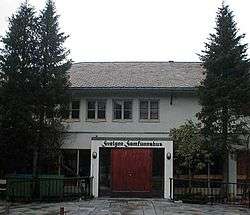
Prior to 1912, the area had no name, other than calling it the end of the Nordgulen fjord or by some of the 3 local farms. In 1912, the village area was named Svelgen, after the nearby river Svelgselva. Since 1917, a large smelting plant in Svelgen has been a cornerstone business for the village. The plant is currently owned by Elkem.[3] Svelgen Chapel is the local church—part of the national Church of Norway.
References
- 1 2 3 Statistisk sentralbyrå (1 January 2013). "Urban settlements. Population and area, by municipality".
- ↑ "Svelgen" (in Norwegian). yr.no. Retrieved 2013-10-29.
- ↑ "Svelgen - tettsted". Store norske leksikon (in Norwegian). Retrieved 2010-06-13.