Suusamyr Too
| Suusamyr Too | |
|---|---|
|
Kyrgyz: Суусамыр тоо кыркасы | |
 | |
| Highest point | |
| Elevation | 4,048 m (13,281 ft) |
| Dimensions | |
| Length | 126 km (78 mi) NW-SE [1] |
| Width | 31 km (19 mi) NE-SW [1] |
| Geography | |
| Country | Kyrgyzstan |
| State/Province | Naryn Region, Jalal-Abad Region |
| District | Jumgal District, Toktogul District |
| Range coordinates | 42°08′N 73°15′E / 42.133°N 73.250°ECoordinates: 42°08′N 73°15′E / 42.133°N 73.250°E |
| Geology | |
| Type of rock | Composed of granite, schist of Lower Paleozoic |
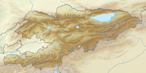
Suusamyr Too (Kyrgyz: Суусамыр тоо кыркасы) is a mountain range in internal Tian Shan in Kyrgyzstan. It separates Suusamyr Valley and Toluk Saragat Valley. The length of the range is 126 km, and height up to 4048m.[1] It is composed of granite, and schist of lower Paleozoic.[2]
References
- 1 2 3 Атлас Кыргызской Республики [Atlas of Kyrgyz Republic] (in Russian). Bishkek: Academy of Sciences of Kyrgyz SSR. 1987. p. 156.
- ↑ Иссык-Куль. Нарын:Энциклопедия [Encyclopedia of Issyk-Kul and Naryn Oblasts] (in Russian). Bishkek: Chief Editorial Board of Kyrgyz Soviet Encyclopedia. 1994. p. 512. ISBN 5-89750-009-6.
This article is issued from
Wikipedia.
The text is licensed under Creative Commons - Attribution - Sharealike.
Additional terms may apply for the media files.