Susan Moore, Alabama
- For the fictional television character, please see Susan Moore (General Hospital)
| Susan Moore, Alabama | |
|---|---|
| Town | |
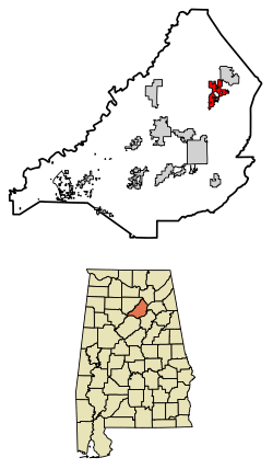 Location of Susan Moore in Blount County, Alabama. | |
| Coordinates: 34°4′55″N 86°25′10″W / 34.08194°N 86.41944°W | |
| Country | United States |
| State | Alabama |
| County | Blount |
| Area[1] | |
| • Total | 5.25 sq mi (13.59 km2) |
| • Land | 5.23 sq mi (13.55 km2) |
| • Water | 0.02 sq mi (0.04 km2) |
| Elevation | 784 ft (239 m) |
| Population (2010) | |
| • Total | 763 |
| • Estimate (2017)[2] | 768 |
| • Density | 146.85/sq mi (56.69/km2) |
| Time zone | UTC-6 (Central (CST)) |
| • Summer (DST) | UTC-5 (CDT) |
| FIPS code | 01-74160 |
| GNIS feature ID | 0116169 |
Susan Moore is a town in Blount County, Alabama, United States. At the 2010 census the population was 763.[3]
Geography
Susan Moore is located in northeastern Blount County at 34°4'54.617" North, 86°25'10.247" West (34.081838, -86.419513),[4] in the Sand Mountain region of Alabama. State Highway 75 passes through the center of the town, leading southwest 10 miles (16 km) to Oneonta, the county seat, and northeast 18 miles (29 km) to Albertville. The Locust Fork of the Black Warrior River flows through the northwest corner of the town.
According to the U.S. Census Bureau, the town has a total area of 5.3 square miles (13.6 km2), of which 0.015 square miles (0.04 km2), or 0.31%, is water.[3]
History
For most of its existence the town of Susan Moore was known by the name Clarence. The area was settled first by the Robert M. Moore family around 1865, and the family continued to play a prominent role in the town for many years. In 1923, two grandsons of Robert Moore, both doctors,donated funds for a new high school, which they named in honor of their mother, Susan Moore. The town gradually came to be referred to as Susan Moore. In November 1982, the town was incorporated, and in December an election was held to determine the new mayor and town council. One of the council's initial actions was to officially rename the town Susan Moore.
Demographics
| Historical population | |||
|---|---|---|---|
| Census | Pop. | %± | |
| 1990 | 658 | — | |
| 2000 | 721 | 9.6% | |
| 2010 | 763 | 5.8% | |
| Est. 2017 | 768 | [2] | 0.7% |
| U.S. Decennial Census[5] 2013 Estimate[6] | |||
As of the census[7] of 2000, there were 721 people, 268 households, and 210 families residing in the town. The population density was 137.6 people per square mile (53.1/km²). There were 304 housing units at an average density of 58.0 per square mile (22.4/km²). The racial makeup of the town was 93.48% White, 0.14% Black or African American, 0.83% Native American, 0.14% Asian, 5.41% from other races. 5.96% of the population were Hispanic or Latino of any race.
There were 268 households out of which 36.9% had children under the age of 18 living with them, 68.3% were married couples living together, 6.7% had a female householder with no husband present, and 21.3% were non-families. 19.8% of all households were made up of individuals and 11.6% had someone living alone who was 65 years of age or older. The average household size was 2.69 and the average family size was 3.07.
In the town, the age distribution of the population shows 26.2% under the age of 18, 10.1% from 18 to 24, 28.8% from 25 to 44, 23.0% from 45 to 64, and 11.8% who were 65 years of age or older. The median age was 34 years. For every 100 females, there were 93.3 males. For every 100 females age 18 and over, there were 90.7 males.
The median income for a household in the town was $35,417, and the median income for a family was $44,167. Males had a median income of $32,431 versus $19,688 for females. The per capita income for the town was $14,540. About 10.3% of families and 10.9% of the population were below the poverty line, including 7.8% of those under age 18 and 28.9% of those age 65 or over.
References
- ↑ "2017 U.S. Gazetteer Files". United States Census Bureau. Retrieved Jul 7, 2018.
- 1 2 "Population and Housing Unit Estimates". Retrieved March 24, 2018.
- 1 2 "Geographic Identifiers: 2010 Demographic Profile Data (G001): Susan Moore town, Alabama". U.S. Census Bureau, American Factfinder. Retrieved September 18, 2013.
- ↑ "US Gazetteer files: 2010, 2000, and 1990". United States Census Bureau. 2011-02-12. Retrieved 2011-04-23.
- ↑ "U.S. Decennial Census". Census.gov. Retrieved June 6, 2013.
- ↑ "Annual Estimates of the Resident Population: April 1, 2010 to July 1, 2013". Retrieved June 3, 2014.
- ↑ "American FactFinder". United States Census Bureau. Retrieved 2008-01-31.
External links
Coordinates: 34°04′55″N 86°25′10″W / 34.081838°N 86.419513°W
Municipalities and communities of Blount County, Alabama, United States | ||
|---|---|---|
| Cities | 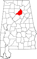 | |
| Towns | ||
| CDP | ||
| Unincorporated communities | ||
| Footnotes | ‡This populated place also has portions in an adjacent county or counties | |