Mount High, Alabama
| Mount High, Alabama | |
|---|---|
| Unincorporated community | |
 Mount High, Alabama  Mount High, Alabama | |
| Coordinates: 34°08′38″N 86°22′44″W / 34.14389°N 86.37889°WCoordinates: 34°08′38″N 86°22′44″W / 34.14389°N 86.37889°W | |
| Country | United States |
| State | Alabama |
| County | Blount |
| Elevation | 860 ft (260 m) |
| Time zone | UTC-6 (Central (CST)) |
| • Summer (DST) | UTC-5 (CDT) |
| Area code(s) | 205 |
| GNIS feature ID | 151807[1] |
Mount High, also known as High Mount, High Mound, or Highmound, is an unincorporated community in Blount County, Alabama, United States, located approximately two miles west of Interstate 65 and Smoke Rise, and approximately 25 miles north of Birmingham. Mount High also is just southwest of Rickwood Caverns State Park.
References
Municipalities and communities of Blount County, Alabama, United States | ||
|---|---|---|
| Cities | 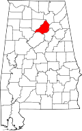 | |
| Towns | ||
| CDP | ||
| Unincorporated communities | ||
| Footnotes | ‡This populated place also has portions in an adjacent county or counties | |
This article is issued from
Wikipedia.
The text is licensed under Creative Commons - Attribution - Sharealike.
Additional terms may apply for the media files.