Sunzhensky District, Republic of Ingushetia
| Sunzhensky District Сунженский район (Russian) Шолжа шахьар (Ingush) | |
|---|---|
.svg.png) Location of Sunzhensky District in the Republic of Ingushetia | |
| Coordinates: 43°19′N 45°04′E / 43.317°N 45.067°ECoordinates: 43°19′N 45°04′E / 43.317°N 45.067°E | |
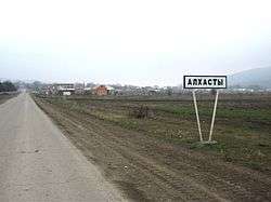 Entrance to the selo of Alkhasty in Sunzhensky District | |
.png) | |
|
| |
| Location | |
| Country | Russia |
| Federal subject | Republic of Ingushetia[1] |
| Administrative structure (as of 2010) | |
| Administrative center | stanitsa of Ordzhonikidzevskaya[1] |
| Inhabited localities: | |
| Rural localities | 11 |
| Municipal structure (as of March 2014) | |
| Municipally incorporated as | Sunzhensky Municipal District[2] |
| Municipal divisions:[2] | |
| Urban settlements | 0 |
| Rural settlements | 11 |
| Statistics | |
| Area | 1,513 km2 (584 sq mi) |
| Population (2010 Census) | 116,470 inhabitants[1] |
| • Urban | 0% |
| • Rural | 100% |
| Density | 76.98/km2 (199.4/sq mi)[3] |
| Time zone | MSK (UTC+03:00)[4] |
| Official website | |
| Sunzhensky District on WikiCommons | |
| 2010 Census | 116,470[1] |
|---|---|
| 2002 Census | 119,826[5] |
Sunzhensky District (Russian: Сунженский райо́н; Ingush: Шолжа шахьар) is an administrative[1] and municipal[2] district (raion), one of the four in the Republic of Ingushetia, Russia. It is located in the eastern and central parts of the republic. The area of the district is 1,513 square kilometers (584 sq mi). Its administrative center is the rural locality (a stanitsa) of Ordzhonikidzevskaya.[1] As of the 2010 Census, the total population of the district was 116,470, with the population of Ordzhonikidzevskaya accounting for 52.9% of that number.[1]
Administrative and municipal status
Within the framework of administrative divisions, Sunzhensky District is one of the four in the Republic of Ingushetia[1] and has administrative jurisdiction over all of its eleven rural localities. As a municipal division, the district is incorporated as Sunzhensky Municipal District.[2] Its eleven rural localities are incorporated into eleven rural settlements within the municipal district.[2] The stanitsa of Ordzhonikidzevskaya serves as the administrative center of both the administrative[1] and municipal[2] district.
Border issues
Sunzhensky and Malgobeksky Districts are a point at issue in the Chechen-Ingush border delimitation discussion.[6]
References
Notes
- 1 2 3 4 5 6 7 8 9 Russian Federal State Statistics Service (2011). "Всероссийская перепись населения 2010 года. Том 1" [2010 All-Russian Population Census, vol. 1]. Всероссийская перепись населения 2010 года (2010 All-Russia Population Census) (in Russian). Federal State Statistics Service. Retrieved June 29, 2012.
- 1 2 3 4 5 6 Law #5-RZ
- ↑ The value of density was calculated automatically by dividing the 2010 Census population by the area specified in the infobox. Please note that this value is only approximate as the area specified in the infobox does not necessarily correspond to the area of the entity proper or is reported for the same year as the population.
- ↑ Правительство Российской Федерации. Федеральный закон №107-ФЗ от 3 июня 2011 г. «Об исчислении времени», в ред. Федерального закона №271-ФЗ от 03 июля 2016 г. «О внесении изменений в Федеральный закон "Об исчислении времени"». Вступил в силу по истечении шестидесяти дней после дня официального опубликования (6 августа 2011 г.). Опубликован: "Российская газета", №120, 6 июня 2011 г. (Government of the Russian Federation. Federal Law #107-FZ of June 31, 2011 On Calculating Time, as amended by the Federal Law #271-FZ of July 03, 2016 On Amending Federal Law "On Calculating Time". Effective as of after sixty days following the day of the official publication.).
- ↑ Russian Federal State Statistics Service (May 21, 2004). "Численность населения России, субъектов Российской Федерации в составе федеральных округов, районов, городских поселений, сельских населённых пунктов – районных центров и сельских населённых пунктов с населением 3 тысячи и более человек" [Population of Russia, Its Federal Districts, Federal Subjects, Districts, Urban Localities, Rural Localities—Administrative Centers, and Rural Localities with Population of Over 3,000] (XLS). Всероссийская перепись населения 2002 года [All-Russia Population Census of 2002] (in Russian). Retrieved August 9, 2014.
- ↑ Chechnya, Ingushetia At Odds Over Border Delimitation. Radio Free Europe/Radio Liberty. December 19, 2008
Sources
- Народное Собрание Республики Ингушетия. Закон №5-РЗ от 23 февраля 2009 г. «Об установлении границ муниципальных образований Республики Ингушетия и наделении их статусом сельского поселения, муниципального района и городского округа», в ред. Закона №9-РЗ от 4 марта 2014 г. «О внесении изменений в Закон Республики Ингушетия "Об установлении границ муниципальных образований Республики Ингушетия и наделении их статусом сельского поселения, муниципального района и городского округа"». Вступил в силу со дня официального опубликования. Опубликован: "Ингушетия", №26–27, 3 марта 2009 г. (People's Assembly of the Republic of Ingushetia. Law #5-RZ of February 23, 2009 On Establishing the Borders of the Municipal Formations of the Republic of Ingushetia and on Granting Them the Status of a Rural Settlement, Municipal District, and Urban Okrug, as amended by the Law #9-RZ of March 4, 2014 On Amending the Law of the Republic of Ingushetia "On Establishing the Borders of the Municipal Formations of the Republic of Ingushetia and on Granting Them the Status of a Rural Settlement, Municipal District, and Urban Okrug". Effective as of the day of the official publication.).
| Districts | |||
|---|---|---|---|
| Cities and towns | |||