Malgobeksky District
| Malgobeksky District Малгобекский район (Russian) Магӏалбика шахьар (Ingush) | |
|---|---|
.svg.png) Location of Malgobeksky District in the Republic of Ingushetia | |
| Coordinates: 43°31′N 44°35′E / 43.517°N 44.583°ECoordinates: 43°31′N 44°35′E / 43.517°N 44.583°E | |
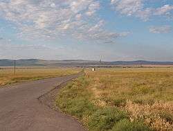 The selo of Novy Redant in Malgobeksky District | |
 | |
|
| |
| Location | |
| Country | Russia |
| Federal subject | Republic of Ingushetia[1] |
| Administrative structure (as of 2010) | |
| Administrative center | town of Malgobek[1] |
| Inhabited localities:[2] | |
| Rural localities | 12 |
| Municipal structure (as of March 2014) | |
| Municipally incorporated as | Malgobeksky Municipal District[3] |
| Municipal divisions:[3] | |
| Urban settlements | 0 |
| Rural settlements | 12 |
| Statistics | |
| Area | 670 km2 (260 sq mi)[4] |
| Population (2010 Census) | 47,754 inhabitants[1] |
| • Urban | 0% |
| • Rural | 100% |
| Density | 71.27/km2 (184.6/sq mi)[5] |
| Time zone | MSK (UTC+03:00)[6] |
| Official website | |
| Malgobeksky District on WikiCommons | |
| 2010 Census | 47,754[1] |
|---|---|
| 2002 Census | 61,617[7] |
| 1989 Census | 25,272[8] |
| 1979 Census | 22,645[9] |
Malgobeksky District (Russian: Малгобе́кский райо́н; Ingush: Магӏалбика шахьар) is an administrative[1] and municipal[3] district (raion), one of the four in the Republic of Ingushetia, Russia. It is located in the north of the republic. The area of the district is 670 square kilometers (260 sq mi).[4] Its administrative center is the town of Malgobek[2] (which is not administratively a part of the district).[1] As of the 2010 Census, the total population of the district was 47,754.[1]
Administrative and municipal status
Within the framework of administrative divisions, Malgobeksky District is one of the four in the Republic of Ingushetia[1] and has administrative jurisdiction over all of its twelve rural localities.[2] The town of Malgobek serves as its administrative center,[2] despite being incorporated separately[1] as a town of republic significance—an administrative unit with the status equal to that of the districts.[2]
As a municipal division, the district is incorporated as Malgobeksky Municipal District.[3] Its twelve rural localities are incorporated into twelve rural settlements within the municipal district.[3] The town of republic significance of Malgobek is incorporated separately from the district as Malgobek Urban Okrug, but serves as the administrative center of the municipal district as well.[3]
Border issues
Malgobeksky and Sunzhensky Districts are a point at issue in the Chechen-Ingush border delimitation discussion.[10]
References
Notes
- 1 2 3 4 5 6 7 8 9 Russian Federal State Statistics Service (2011). "Всероссийская перепись населения 2010 года. Том 1" [2010 All-Russian Population Census, vol. 1]. Всероссийская перепись населения 2010 года (2010 All-Russia Population Census) (in Russian). Federal State Statistics Service. Retrieved June 29, 2012.
- 1 2 3 4 5 "About the Region". Malgobeksky District (Official Site). Malgobeksky District. Retrieved 22 October 2016.
- 1 2 3 4 5 6 Law #5-RZ
- 1 2 "General Information" (in Russian). Malgobeksky District. Retrieved August 31, 2016.
- ↑ The value of density was calculated automatically by dividing the 2010 Census population by the area specified in the infobox. Please note that this value is only approximate as the area specified in the infobox does not necessarily correspond to the area of the entity proper or is reported for the same year as the population.
- ↑ Правительство Российской Федерации. Федеральный закон №107-ФЗ от 3 июня 2011 г. «Об исчислении времени», в ред. Федерального закона №271-ФЗ от 03 июля 2016 г. «О внесении изменений в Федеральный закон "Об исчислении времени"». Вступил в силу по истечении шестидесяти дней после дня официального опубликования (6 августа 2011 г.). Опубликован: "Российская газета", №120, 6 июня 2011 г. (Government of the Russian Federation. Federal Law #107-FZ of June 31, 2011 On Calculating Time, as amended by the Federal Law #271-FZ of July 03, 2016 On Amending Federal Law "On Calculating Time". Effective as of after sixty days following the day of the official publication.).
- ↑ Russian Federal State Statistics Service (May 21, 2004). "Численность населения России, субъектов Российской Федерации в составе федеральных округов, районов, городских поселений, сельских населённых пунктов – районных центров и сельских населённых пунктов с населением 3 тысячи и более человек" [Population of Russia, Its Federal Districts, Federal Subjects, Districts, Urban Localities, Rural Localities—Administrative Centers, and Rural Localities with Population of Over 3,000] (XLS). Всероссийская перепись населения 2002 года [All-Russia Population Census of 2002] (in Russian). Retrieved August 9, 2014.
- ↑ Demoscope Weekly (1989). "Всесоюзная перепись населения 1989 г. Численность наличного населения союзных и автономных республик, автономных областей и округов, краёв, областей, районов, городских поселений и сёл-райцентров" [All Union Population Census of 1989: Present Population of Union and Autonomous Republics, Autonomous Oblasts and Okrugs, Krais, Oblasts, Districts, Urban Settlements, and Villages Serving as District Administrative Centers]. Всесоюзная перепись населения 1989 года [All-Union Population Census of 1989] (in Russian). Институт демографии Национального исследовательского университета: Высшая школа экономики [Institute of Demography at the National Research University: Higher School of Economics]. Retrieved August 9, 2014.
- ↑ "Всесоюзная перепись населения 1979 г. Национальный состав населения по регионам России. (All Union Population Census of 1979. Ethnic composition of the population by regions of Russia.)". Всесоюзная перепись населения 1979 года (All-Union Population Census of 1979) (in Russian). Demoscope Weekly (website of the Institute of Demographics of the State University—Higher School of Economics. 1979. Retrieved 2008-11-25.
- ↑ Chechnya, Ingushetia at Odds over Border Delimitation. Radio Free Europe/Radio Liberty. December 19, 2008
Sources
- Народное Собрание Республики Ингушетия. Закон №5-РЗ от 23 февраля 2009 г. «Об установлении границ муниципальных образований Республики Ингушетия и наделении их статусом сельского поселения, муниципального района и городского округа», в ред. Закона №9-РЗ от 4 марта 2014 г. «О внесении изменений в Закон Республики Ингушетия "Об установлении границ муниципальных образований Республики Ингушетия и наделении их статусом сельского поселения, муниципального района и городского округа"». Вступил в силу со дня официального опубликования. Опубликован: "Ингушетия", №26–27, 3 марта 2009 г. (People's Assembly of the Republic of Ingushetia. Law #5-RZ of February 23, 2009 On Establishing the Borders of the Municipal Formations of the Republic of Ingushetia and on Granting Them the Status of a Rural Settlement, Municipal District, and Urban Okrug, as amended by the Law #9-RZ of March 4, 2014 On Amending the Law of the Republic of Ingushetia "On Establishing the Borders of the Municipal Formations of the Republic of Ingushetia and on Granting Them the Status of a Rural Settlement, Municipal District, and Urban Okrug". Effective as of the day of the official publication.).
| Districts | |||
|---|---|---|---|
| Cities and towns | |||