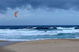
Sunshine Beach, Queensland
| Sunshine Beach Noosa, Queensland | |||||||||||||||
|---|---|---|---|---|---|---|---|---|---|---|---|---|---|---|---|
 Sunshine Beach, 2010 | |||||||||||||||
| Population | 2,460 (2016 census)[1] | ||||||||||||||
| • Density | 1,118/km2 (2,900/sq mi) | ||||||||||||||
| Postcode(s) | 4567 | ||||||||||||||
| Area | 2.2 km2 (0.8 sq mi) | ||||||||||||||
| Location | 4 km (2 mi) SE of Noosa Heads | ||||||||||||||
| LGA(s) | Shire of Noosa | ||||||||||||||
| State electorate(s) | Noosa | ||||||||||||||
| Federal Division(s) | Wide Bay | ||||||||||||||
| |||||||||||||||
Coordinates: 26°24′25″S 153°06′18″E / 26.407°S 153.105°E
Sunshine Beach is a suburb in Noosa, Queensland, Australia. within the local government area of Shire of Noosa (between 2008 and 2013 it was within Sunshine Coast Region). At the 2016 Australian Census, the suburb recorded a population of 2,460.[1]
History
The area south of Noosa Headlands was formerly known as Golden Beach but was rarely visited before the 1920s. In 1928, Thomas Marcus Burke gained land there in exchange for building roads and bridges from Tewantin. After World War II it was marketed by his son, Marcus, as Sunshine Beach.[2]
Amenities
Sunshine Beach is home to the Sunshine Beach Surf Lifesaving Club from which volunteers patrol the beach every weekend from September school holidays to ANZAC Day.
Education
Saint Thomas More Primary School is a Roman Catholic Primary School that was established in 1990 by The Noosa District Roman Catholic Parish and is staffed by the Brisbane Catholic Education Centre. It is a Marist school.[3]
References
- 1 2 Australian Bureau of Statistics (27 June 2017). "Sunshine Beach (State Suburb)". 2016 Census QuickStats. Retrieved 29 March 2018.

- ↑ Noosa Community Guide 2005 Part D Archived 24 July 2008 at the Wayback Machine. 19 December 2006
- ↑ "Welcome to Saint Thomas More Primary School Sunshine Beach". Saint Thomas More Primary School. Archived from the original on 22 May 2009. Retrieved 22 February 2012.
External links