Sundsvall–Timrå Airport
| Sundsvall–Timrå Airport | |||||||||||
|---|---|---|---|---|---|---|---|---|---|---|---|
.JPG) | |||||||||||
| Summary | |||||||||||
| Airport type | Public | ||||||||||
| Owner | Municipalities of Sundsvall and Timrå | ||||||||||
| Operator | Midlanda Flygplats AB | ||||||||||
| Location |
Timrå, but mainly serves Sundsvall and Härnösand, Sweden | ||||||||||
| Elevation AMSL | 16 ft / 5 m | ||||||||||
| Coordinates | 62°31′41″N 17°26′38″E / 62.52806°N 17.44389°ECoordinates: 62°31′41″N 17°26′38″E / 62.52806°N 17.44389°E | ||||||||||
| Website | www.sdlairport.se | ||||||||||
| Map | |||||||||||
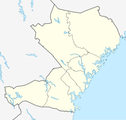 SDL Location of airport in Västernorrland | |||||||||||
| Runways | |||||||||||
| |||||||||||
| Statistics (2011) | |||||||||||
| |||||||||||
|
Statistics: Swedavia[1] | |||||||||||
Sundsvall–Timrå Airport (IATA: SDL, ICAO: ESNN) is about 21 km north of Sundsvall, 8 km east of Timrå and 32 km south of Härnösand, Sweden. The airport is also known as Midlanda, referring to its geographically central location in Sweden. The airport was known under the name Sundsvall–Härnösand Airport until the municipalities of Sundsvall and Timrå obtained the ownership of the airport from Swedavia on June 17, 2013.[2] Sundsvall–Timrå Airport is Norrland's fourth-busiest airport and the country's eleventh busiest. The airport counted 282,047 passengers in 2011.[1]
It was built on delta land formed by much sediment and flood debris that washed down the Indalsälven river to the sea when the lake Ragundasjön drained suddenly and catastrophically in 1796.
Airlines and destinations
| Airlines | Destinations |
|---|---|
| Aegean Airlines | Seasonal charter: Chania[3][4][5] |
| BRA Braathens Regional Airlines | Gothenburg, Stockholm–Bromma Seasonal: Visby |
| Scandinavian Airlines | Stockholm–Arlanda |
| Scandjet | Seasonal charter: Rijeka, Zadar |
Cargo
| Airlines | Destinations |
|---|---|
| Amapola Flyg | Malmö,[6] Stockholm–Arlanda,[7] Umeå[8] |
Accidents
On December 12, 1999, a Piper PA-31 Navajo crashed shortly after takeoff. All eight onboard died (pilot and seven passengers).[9] This was not a regular flight, but a taxi flight with paying passengers.[10]
See also
References
- 1 2 "Statistics". Swedavia. Archived from the original on 17 March 2012. Retrieved 17 March 2012.
- ↑ "Swedavia överlämnar Sundsvall Härnösand Airport". 13 June 2013. Archived from the original on 5 August 2013. Retrieved 8 October 2013.
- ↑ "apollo". apollo.se. Retrieved 31 May 2015.
- ↑ "A34556 flight history". flightradar24.com. Retrieved 31 May 2015.
- ↑ "A34557 flight history". flightradar24.com. Retrieved 31 May 2015.
- ↑ https://www.flightradar24.com/data/airlines/hp-apf/routes
- ↑ https://www.flightradar24.com/data/airlines/hp-apf/routes
- ↑ https://www.flightradar24.com/data/airlines/hp-apf/routes
- ↑ ASN Wikibase Occurrence # 25505
- ↑ Tio år sedan den svåra flygolyckan
External links
![]()
- Official website
- Airport information for ESNN at World Aero Data. Data current as of October 2006.
- Google Earth air view of Sundsvall–Härnösand Airport, showing its place in a river's delta