Sugar Camp (community), Wisconsin
| Sugar Camp, Wisconsin | |
|---|---|
| Unincorporated community | |
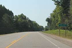 The sign for Sugar Camp, Wisconsin on WIS17 | |
 Sugar Camp, Wisconsin  Sugar Camp, Wisconsin | |
| Coordinates: 45°47′40″N 89°18′50″W / 45.79444°N 89.31389°WCoordinates: 45°47′40″N 89°18′50″W / 45.79444°N 89.31389°W | |
| Country | United States |
| State | Wisconsin |
| County | Oneida |
| Elevation | 1,660 ft (510 m) |
| Time zone | UTC-6 (Central (CST)) |
| • Summer (DST) | UTC-5 (CDT) |
| Area code(s) | 715 & 534 |
| GNIS feature ID | 1575015[1] |
Sugar Camp is an unincorporated community located in the town of Sugar Camp, Oneida County, Wisconsin, United States. Sugar Camp is located on Sugar Camp Lake along Wisconsin Highway 17, 11.5 miles (18.5 km) north-northeast of Rhinelander.[2]
Images
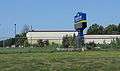 Sugar Camp Elementary School
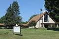 St. Kunegunda Catholic Church
References
| Wikimedia Commons has media related to Sugar Camp, Wisconsin. |
- ↑ U.S. Geological Survey Geographic Names Information System: Sugar Camp (community), Wisconsin
- ↑ Oneida County (PDF) (Map). Wisconsin Department of Transportation. 2011. Archived from the original (PDF) on June 14, 2011. Retrieved September 2, 2011.
Municipalities and communities of Oneida County, Wisconsin, United States | ||
|---|---|---|
| City | 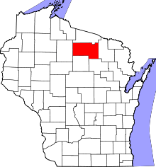 | |
| Towns | ||
| CDPs | ||
| Unincorporated communities | ||
| Ghost town/neighborhood | ||
| Footnotes | ‡This populated place also has portions in an adjacent county or counties | |
This article is issued from
Wikipedia.
The text is licensed under Creative Commons - Attribution - Sharealike.
Additional terms may apply for the media files.