Strelley Village
| Strelley | |
|---|---|
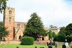 All Saints' Church, Strelley | |
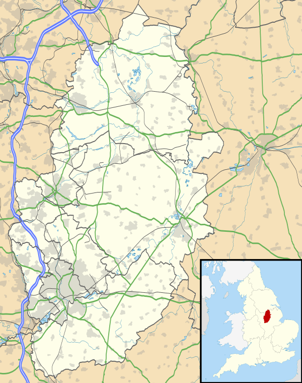 Strelley Strelley shown within Nottinghamshire | |
| Population | 653 (2011) |
| OS grid reference | SK 50488 42167 |
| District | |
| Shire county | |
| Region | |
| Country | England |
| Sovereign state | United Kingdom |
| Post town | NOTTINGHAM |
| Postcode district | NG8 |
| Dialling code | 0115 |
| Police | Nottinghamshire |
| Fire | Nottinghamshire |
| Ambulance | East Midlands |
| EU Parliament | East Midlands |
Strelley is the name of a village and civil parish to the west of Nottingham. The population of the civil parish taken at the 2011 census was 653.[1] It is also the name of the nearby post war council housing estate. The village lies within Broxtowe, whilst the estate is in the City of Nottingham. The village is separated from the housing estate by the A6002 road.
Village
The village of Strelley was first recorded in the Domesday Book in 1086.
The village has quite a secluded atmosphere as it is not on a through road for traffic, although bridleways ran from the village to Cossall to the west, and to Kimberley to the north. The old Broad Oak pub, remains but has been partially modernised.
Strelley is also notable for being the upper terminus of one of the earliest recorded railway lines in the world, the Wollaton Waggonway. The railway ran to Wollaton. Horse-drawn coal wagons travelled to their destination on wooden railway lines. This type of railway is known as a wagonway and it was completed during 1604. It was built by Huntingdon Beaumont working in partnership with the second occupier of Wollaton Hall, Sir Percival Willoughby. Coal mining was a significant industry in Strelley during Elizabethan and Stuart times. Notable families involved in the early mining of Strelley included the Strelleys and the Byrons; it was a Byron who sub-leased the pits to Huntingdon Beaumont.
During the 1960s much of the western part of Strelley parish was dominated by a huge opencast coal mine. After the opencast mine closed, the M1 motorway was constructed over the west of the parish. The village church All Saints' Church, Strelley can now easily be seen from the motorway just north of the Trowell services area.
Geography
The main television transmitter for Nottingham is in the parish, which takes signals from Waltham.[2][3] The transmitter is also known as Swingate as it is east of Swingate Farm. The transmitter is next to the Kimberley parish boundary, and the Robin Hood Way. The transmitter base is at a height of around 130 metres, and near a trig point at Windmill Farm.
References
- ↑ "Civil Parish population 2011". Neighbourhood Statistics. Office for National Statistics. Retrieved 15 April 2016.
- ↑ Freeview Nottingham transmitter
- ↑ MB21 Nottingham transmitter
- Smith, R S (1989), Early Coal Mining Around Nottingham 1500 – 1650, University of Nottingham (out of print) .
| About Nottingham | |
|---|---|
| Areas of Nottingham | |
| |
| Unitary authorities | |
|---|---|
| Boroughs or districts | |
| Major settlements | |
| Topics | |