Straßfeld
| Map |
|---|
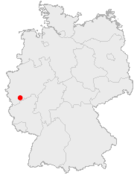 |
Straßfeld is a village in the municipality Swisttal in the North Rhine-Westphalian Rhein-Sieg district. It is situated approximately 24 km west of Bonn. In 2007 it had 465 inhabitants.[1]
References
- ↑ References: Website der Gemeinde Swisttal Archived 2007-07-05 at the Wayback Machine.
External links
Coordinates: 50°42′N 6°52′E / 50.700°N 6.867°E
This article is issued from
Wikipedia.
The text is licensed under Creative Commons - Attribution - Sharealike.
Additional terms may apply for the media files.