Stoke St Gregory
| Stoke St Gregory | |
|---|---|
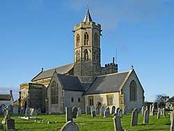 St Gregory's parish church | |
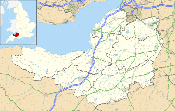 Stoke St Gregory Stoke St Gregory shown within Somerset | |
| Population | 942 (2011 Census) |
| OS grid reference | ST3427 |
| Civil parish |
|
| District | |
| Shire county | |
| Region | |
| Country | England |
| Sovereign state | United Kingdom |
| Post town | Taunton |
| Postcode district | TA3 |
| Dialling code | 01823 |
| Police | Avon and Somerset |
| Fire | Devon and Somerset |
| Ambulance | South Western |
| EU Parliament | South West England |
| UK Parliament | |
| Website | Stoke St Gregory |
Stoke St Gregory is a village and civil parish in Somerset, England, about 7 miles (11 km) east of Taunton in the Taunton Deane district. The village is on a low ridge of land between the River Tone to the north and West Sedgemoor to the south. The 2011 Census recorded the parish's population as 942.[1]
History
The parish of Stoke St Gregory was part of the North Curry Hundred.[2] The manor was held, with North Curry, from 1190 by the dean and chapter of Wells Cathedral.[3]
The parish includes the Willows and Wetlands visitor centre which offers tours of more than 80 acres (0.12 sq mi) of withies, willow yards and basket workshops and explains the place of willow in the history of the Somerset Levels. Lovell's Farm has a withy boiler that was built in 1906.[4]
Slough Farmhouse, formerly called Slough Court, was built in the late Middle Ages as a fortified manor house. It is a Grade II* listed building.[5]
Governance
The civil parish has a parish council. The parish is in the Non-metropolitan district of Taunton Deane and the non-metropolitan county of Somerset, governed by Somerset County Council. Taunton Deane District was formed on 1 April 1974 under the Local Government Act 1972, having previously been part of Taunton Rural District.[6]
Stoke St Gregory is part of Taunton Deane county constituency, represented in the House of Commons of the Parliament of the United Kingdom. It elects one Member of Parliament (MP) by the first past the post system of election, and part of the South West England constituency of the European Parliament which elects seven MEPs using the d'Hondt method of party-list proportional representation.
Church and chapel
The Church of England parish of church of St Gregory was built in the 14th century. It has some 15th- and 18th-century features, was twice restored in the 19th century and is a Grade I listed building.[7] There is a set of 17th- or 18th-century stocks in the churchyard.[8]
The Baptist Church was built in 1895 and has stables at the rear.[9]
References
- ↑ "Statistics for Wards, LSOAs and Parishes — SUMMARY Profiles" (Excel). Somerset Intelligence. Retrieved 4 January 2014.
- ↑ "Somerset Hundreds". GENUKI. Retrieved 17 October 2011.
- ↑ Bush, Robin (1994). Somerset: The Complete Guide. Dovecote Press. p. 196. ISBN 1-874336-26-1.
- ↑ Historic England. "Withy boiler at NGR ST 3534 2764 (Grade II) (1177704)". National Heritage List for England. Retrieved 18 October 2017.
- ↑ Historic England. "Slough Farmhouse (Grade II*) (1344637)". National Heritage List for England. Retrieved 18 October 2017.
- ↑ "Tainton RD". A vision of Britain Through Time. University of Portsmouth. Retrieved 5 January 2014.
- ↑ Historic England. "Church of St Gregory (Grade I) (1060242)". National Heritage List for England. Retrieved 18 October 2017.
- ↑ Historic England. "Stocks in churchyard, about 14 metres south of porch, Church of St Gregory (Grade II) (1344638)". National Heritage List for England. Retrieved 18 October 2017.
- ↑ Historic England. "Baptist church and former stables at rear (Grade II) (1307290)". National Heritage List for England. Retrieved 18 October 2017.
Further reading
- Pevsner, Nikolaus (1958). South and West Somerset. The Buildings of England. Harmondsworth: Penguin Books. pp. 302–303.
External links
| Wikimedia Commons has media related to Stoke St Gregory. |
