Stepenitztal
| Stepenitztal | |
|---|---|
 Stepenitztal Location of Stepenitztal within Nordwestmecklenburg district 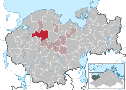 | |
| Coordinates: 53°52′N 11°05′E / 53.867°N 11.083°ECoordinates: 53°52′N 11°05′E / 53.867°N 11.083°E | |
| Country | Germany |
| State | Mecklenburg-Vorpommern |
| District | Nordwestmecklenburg |
| Municipal assoc. | Grevesmühlen-Land |
| Area | |
| • Total | 45.03 km2 (17.39 sq mi) |
| Elevation | 29 m (95 ft) |
| Population (2017-12-31)[1] | |
| • Total | 1,711 |
| • Density | 38/km2 (98/sq mi) |
| Time zone | CET/CEST (UTC+1/+2) |
| Postal codes | 23936, 23923 |
| Dialling codes | 038824, 03881 |
| Vehicle registration | NWM |
| Website | www.grevesmuehlen.de |
Stepenitztal is a municipality in the Nordwestmecklenburg district, in Mecklenburg-Vorpommern, Germany. It takes its name from the river Stepenitz. It was formed on 25 May 2014 by the merger of the former municipalities Börzow, Mallentin and Papenhusen.
References
This article is issued from
Wikipedia.
The text is licensed under Creative Commons - Attribution - Sharealike.
Additional terms may apply for the media files.