Schildetal
| Schildetal | |
|---|---|
 Schildetal Location of Schildetal within Nordwestmecklenburg district 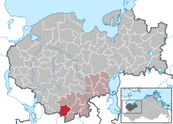 | |
| Coordinates: 53°37′N 11°08′E / 53.617°N 11.133°ECoordinates: 53°37′N 11°08′E / 53.617°N 11.133°E | |
| Country | Germany |
| State | Mecklenburg-Vorpommern |
| District | Nordwestmecklenburg |
| Municipal assoc. | Lützow-Lübstorf |
| Area | |
| • Total | 19.39 km2 (7.49 sq mi) |
| Elevation | 44 m (144 ft) |
| Population (2017-12-31)[1] | |
| • Total | 760 |
| • Density | 39/km2 (100/sq mi) |
| Time zone | CET/CEST (UTC+1/+2) |
| Postal codes | 19209 |
| Dialling codes | 038874 |
| Vehicle registration | NWM |
| Website | www.amt-luetzow.de |
Schildetal is a municipality in the Nordwestmecklenburg district, in Mecklenburg-Vorpommern, Germany.
References
| Authority control |
|---|
This article is issued from
Wikipedia.
The text is licensed under Creative Commons - Attribution - Sharealike.
Additional terms may apply for the media files.