Steinenbronn
| Steinenbronn | ||
|---|---|---|
| ||
 Steinenbronn Location of Steinenbronn within Böblingen district 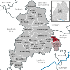  | ||
| Coordinates: 48°39′53″N 09°07′21″E / 48.66472°N 9.12250°ECoordinates: 48°39′53″N 09°07′21″E / 48.66472°N 9.12250°E | ||
| Country | Germany | |
| State | Baden-Württemberg | |
| Admin. region | Stuttgart | |
| District | Böblingen | |
| Government | ||
| • Mayor | Johann Singer | |
| Area | ||
| • Total | 9.72 km2 (3.75 sq mi) | |
| Elevation | 431 m (1,414 ft) | |
| Population (2017-12-31)[1] | ||
| • Total | 6,638 | |
| • Density | 680/km2 (1,800/sq mi) | |
| Time zone | CET/CEST (UTC+1/+2) | |
| Postal codes | 71144 | |
| Dialling codes | 07157 | |
| Vehicle registration | BB | |
| Website | www.steinenbronn.de | |

Steinenbronn is a town in the district of Böblingen in Baden-Württemberg in Germany. The district has one public school and five kindergartens. The east side is industrial while the west side of the town is rather urban.
Geography
Steinenbronn lies on the edge of the Nationalpark Schönbuch at the old trade route Stuttgart - Tübingen, five kilometers south of Leinfelden-Echterdingen, three kilometers north of Waldenbuch and five kilometers east of Schönaich.
Politics
Mayor
since the end of World War II:
- 1945–1950: Gottlob Krauß
- 1950–1980: Reinhold Buck
- 1980–1996: Hermann Walz
- since 1996: Johann Singer
Municipal Council
Elections in May 2014:
- Freie Wähler (Free voters): 5 seats
- CDU: 5 seats
- Offene Grüne Liste (Open green list): 2 seats
- SPD: 2 seats
Infrastructure
From 1928 to 1965 Steinenbronn was part of the Siebenmühlentalbahn (Leinfelden-Waldenbuch). Today Steinenbronn is connected to the mass transit of Stuttgart. Steinenbronn is located at the former Bundesstraße 27, now Landstraße 1208 which connects Stuttgart and Tübingen.
important Distances:
- Stuttgart-Airport: 8 km
- Stuttgart: 20 km
- Tübingen: 24 km
Education
Steinenbronn is the seat of a secondary school with more than 400 students.
Twin towns [2]
References
- ↑ "Bevölkerung nach Nationalität und Geschlecht am 31. Dezember 2017". Statistisches Landesamt Baden-Württemberg (in German). 2018.
- ↑ http://www.steinenbronn.de/servlet/PB/menu/1179755_l1/index.html
Towns and municipalities in Böblingen (district) | ||
|---|---|---|