Staves, Arkansas
| Staves, Arkansas | |
|---|---|
| Census-designated place | |
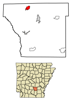 Location of Staves in Cleveland County, Arkansas. | |
 Staves Location of Staves in Cleveland County, Arkansas. | |
| Coordinates: 34°02′21″N 92°16′39″W / 34.03917°N 92.27750°WCoordinates: 34°02′21″N 92°16′39″W / 34.03917°N 92.27750°W | |
| Country | United States |
| State | Arkansas |
| County | Cleveland |
| Area[1] | |
| • Total | 2.44 sq mi (6.31 km2) |
| • Land | 2.43 sq mi (6.30 km2) |
| • Water | 0.00 sq mi (0.01 km2) |
| Elevation | 256 ft (78 m) |
| Population (2010)[2] | |
| • Total | 2,274 |
| • Estimate (2016)[3] | N/A |
| Time zone | UTC-6 (Central (CST)) |
| • Summer (DST) | UTC-5 (CDT) |
| Area code(s) | 870 |
| GNIS feature ID | 58684[4] |
Staves is a census-designated place in Cleveland County, Arkansas, United States. Its population was 116 as of the 2010 census.[2]
Staves was known locally as the "Y" Community, because State Route 212 created a "Y" where it intersected State Route 35, with connectors leading both north and south from State Route 212's east-west direction. The road has since been modified and a third stretch of road has been added to connect State Route 212 at a 90 degree angle to State Route 35.
Demographics
| Historical population | |||
|---|---|---|---|
| Census | Pop. | %± | |
| U.S. Decennial Census[5] | |||
References
- ↑ "2016 U.S. Gazetteer Files". United States Census Bureau. Retrieved Jul 18, 2017.
- 1 2 "Geographic Identifiers: 2010 Demographic Profile Data (G001): Staves CDP, Arkansas". U.S. Census Bureau, American Factfinder. Retrieved June 17, 2014.
- ↑ "Population and Housing Unit Estimates". Retrieved June 9, 2017.
- ↑ U.S. Geological Survey Geographic Names Information System: Staves, Arkansas
- ↑ "Census of Population and Housing". Census.gov. Retrieved June 4, 2016.
Municipalities and communities of Cleveland County, Arkansas, United States | ||
|---|---|---|
| Cities | 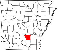 | |
| CDPs | ||
| Unincorporated communities | ||
This article is issued from
Wikipedia.
The text is licensed under Creative Commons - Attribution - Sharealike.
Additional terms may apply for the media files.