Jilemnice
| Jilemnice | |||
| Town | |||
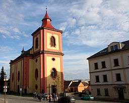 Saint Lawrence Church | |||
|
|||
| Country | Czech Republic | ||
|---|---|---|---|
| Region | Liberec | ||
| District | Semily | ||
| Commune | Jilemnice | ||
| Elevation | 451 m (1,480 ft) | ||
| Coordinates | 50°36′34″N 15°30′23″E / 50.60944°N 15.50639°ECoordinates: 50°36′34″N 15°30′23″E / 50.60944°N 15.50639°E | ||
| Area | 13.86 km2 (5.35 sq mi) | ||
| Population | 5,476 | ||
| Density | 395/km2 (1,023/sq mi) | ||
| First mentioned | 14th century | ||
| Mayor | Jana Čechová | ||
| Timezone | CET (UTC+1) | ||
| - summer (DST) | CEST (UTC+2) | ||
| Postal code | 514 01 | ||
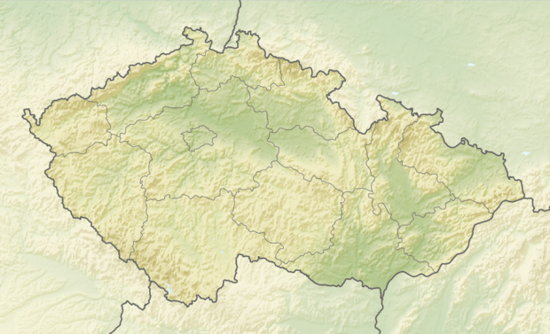 Location in the Czech Republic | |||
| Wikimedia Commons: Jilemnice | |||
| Statistics: statnisprava.cz | |||
| Website: www.mestojilemnice.cz | |||
Jilemnice (Czech pronunciation: [ˈjɪlɛmɲɪtsɛ]; German: Starkenbach) is a town in the Czech Republic.
It is one of the most northern Czech towns, near the Krkonoše.
History
It belonged to the younger branch of counts Harrach.
Until 1918, Jilemnice was part of the Austrian monarchy (Austria side after the compromise of 1867), head of the district of the same name, one of the 94 Bezirkshauptmannschaften in Bohemia.[1]
Notable persons from Jilemnice
- Josef Jan Hanuš - World War II pilot
- Jaroslav Havlíček - writer
- Jakub Hlava - ski jumper
- Lukáš Hlava - ski jumper
- Eva Puskarčíková - biathlete
- Aleš Vodseďálek - Nordic combined skier
- Jan Weiss - writer
References
- ↑ Die postalischen Abstempelungen auf den österreichischen Postwertzeichen-Ausgaben 1867, 1883 und 1890, Wilhelm KLEIN, 1967
External links

- Municipal website
This article is issued from
Wikipedia.
The text is licensed under Creative Commons - Attribution - Sharealike.
Additional terms may apply for the media files.