St David's Head
| St David's Head | |
|---|---|
| Penmaen Dewi | |
 | |
 Location in Wales | |
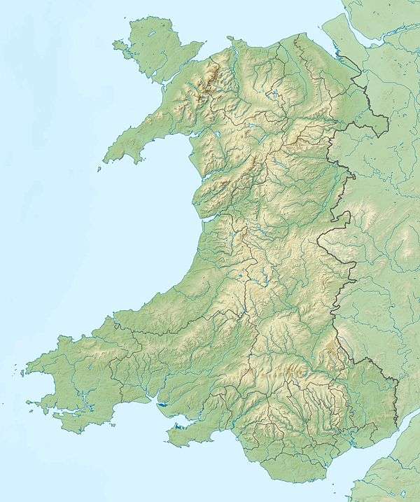
| Location | Pembrokeshire, Wales |
| Coordinates | 51°54′10″N 5°18′45″W / 51.902778°N 5.3125°WCoordinates: 51°54′10″N 5°18′45″W / 51.902778°N 5.3125°W |
| Geology | headland |
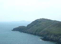
St Davids Head (Welsh: Penmaen Dewi) is a headland in the Pembrokeshire Coast National Park, in southwest Wales. This headland is considered the southern limit of the Irish Sea in Wales.[1] To the south is the Celtic Sea.
Northwest of the cathedral city of St David's and jutting into the Irish Sea, St Davids Head marks the southern extremity of the large Cardigan Bay. To the south are Whitesands Bay, Ramsey Sound (separating Ramsey Island) and St Brides Bay. The headland and its immediate hinterland are owned by the National Trust.
Described in a Roman survey of the known world in 140 AD (Ptolemy's Geography) as the 'Promontory of the Eight Perils' (Οκταπιταρον Ακρον - Oktapitaron Akron - in Ptolemy's original Greek). There are views to the north, of the wide expanse of the Irish Sea; to the west, of the Bishops and Clerks rocks; to the south, of Whitesands Bay to Ramsey Sound and Ramsey Island; and to the east, of the slopes of the large rocky outcrop known as Carn Llidi.[2]
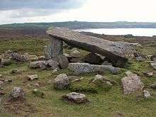
There are a number of ancient monuments showing signs of early occupation, including, an iron age cliff fort, prehistoric settlements, a prehistoric defensive wall, signs of various neolithic field systems and Coetan Arthur (Arthur’s Quoit) burial chamber.[3][4]
The headland can only be reached on foot along the coastal path, the nearest road ending at Whitesands bay about a mile to the south-east.
In 1793 Sir Richard Cold Hoare said in his "Journal of a Tour of South Wales":[5]
"No place could ever be more suited to retirement, contemplation or Druidical mysteries, surrounded by inaccessible rock and open to a wide expanse of ocean. Nothing seems wanting but the thick impenetrable groves of oaks which have been thought concomitant to places of Druidical worship and which, from the exposed nature of this situation, would never, I think, have existed here even in former days."
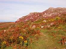
The headland is abundant in wildflowers and wildlife and the waters around it provide a rich habitat for fish, grey seals and porpoises. A variety of seabirds and peregrine falcons are also to be seen.[6]
Shipwreck
Tarleton, a slaver of 400 tons (burthen), Christian, master, foundered on 28 November 1788 off St David's Head on her way from Liverpool to Africa. Her crew was saved.[7]
References
- ↑ C.Michael Hogan. 2011. Irish Sea. eds P.Saundry & C.Cleveland. encyclopedia of Earth. National Council for Science and the Environment. Washington DC
- ↑ http://www.walkingbritain.co.uk/walks/walks/walk_b/2057/ Retrieved on 2008-01-07
- ↑ http://www.ucl.ac.uk/prehistoric/pps/abstracts/abs67.html Retrieved on 2008-01-07
- ↑ http://myweb.tiscali.co.uk/celynog/st_david's_head.htm Retrieved on 2008-01-07
- ↑ "Archived copy". Archived from the original on 2009-11-22. Retrieved 2009-11-10. Retrieved on 2008-01-07
- ↑ http://www.bbc.co.uk/wales/southwest/nature/thingstodo/walks/allwalks/st_davids_head.shtml Retrieved on 2008-01-07
- ↑ Lloyd's List №1788.
External links
- National Trust page
- Map sources for St David's Head
- Coetan Arthur
- Photos of St Davids Head on geograph.org.uk