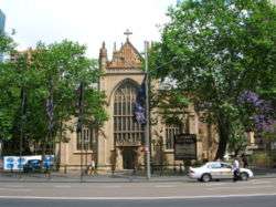
Parish of St Andrew
| St Andrew New South Wales | |||||||||||||||
|---|---|---|---|---|---|---|---|---|---|---|---|---|---|---|---|
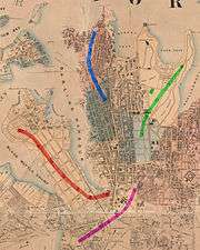 Location in Sydney city highlighted in red on an 1857 map | |||||||||||||||
| Established | 1835 | ||||||||||||||
| LGA(s) | City of Sydney | ||||||||||||||
| County | Cumberland | ||||||||||||||
| Hundred (former) | Sydney | ||||||||||||||
| |||||||||||||||
St Andrew Parish, Cumberland is one of the 57 parishes of Cumberland County, New South Wales, a cadastral unit for use on land titles. It is one of the four small parishes in the Sydney city area, which is named after the church of St Andrew's. The parish was named while the church was still in the planning stages. The parish includes Pyrmont and the Darling Harbour area. It is bounded by Wattle Street in the south west, George Street in the south and east, and King Street in the north-east.[1] It includes Town Hall railway station, which is on the eastern end of the parish.
Locations
Images of locations in the parish:
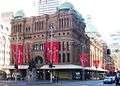 The Queen Victoria Building at the eastern end of the parish
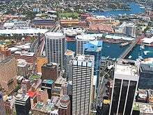 Buildings in the Darling Harbour area; most of this land is in the Parish of St Andrew except for Wentworth Park and the land beyond it.
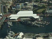
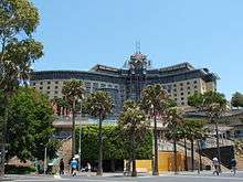
 The University of Technology is located on the southern end of the parish.

Coordinates: 33°52′26″S 151°12′23″E / 33.87389°S 151.20639°E
References
- "St Andrew". Geographical Names Register (GNR) of NSW. Geographical Names Board of New South Wales.
- ↑ Information obtained from maps available at the NSW Dept. of Lands Parish map preservation project
This article is issued from
Wikipedia.
The text is licensed under Creative Commons - Attribution - Sharealike.
Additional terms may apply for the media files.