St. Theresa Point Airport
| St. Theresa Point Airport | |||||||||||
|---|---|---|---|---|---|---|---|---|---|---|---|
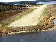 Threshold of runway 22 | |||||||||||
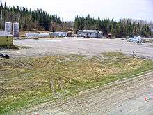 St. Theresa Terminal building | |||||||||||
| Summary | |||||||||||
| Airport type | Public | ||||||||||
| Operator | Government of Manitoba | ||||||||||
| Location | St. Theresa Point, Manitoba | ||||||||||
| Time zone | CST (UTC−06:00) | ||||||||||
| • Summer (DST) | CDT (UTC−05:00) | ||||||||||
| Elevation AMSL | 767 ft / 234 m | ||||||||||
| Coordinates | 53°50′44″N 094°51′08″W / 53.84556°N 94.85222°WCoordinates: 53°50′44″N 094°51′08″W / 53.84556°N 94.85222°W | ||||||||||
| Map | |||||||||||
 CYST Location in Manitoba | |||||||||||
| Runways | |||||||||||
| |||||||||||
| Statistics (2010) | |||||||||||
| |||||||||||
St. Theresa Point Airport (IATA: YST, ICAO: CYST) is located on St Mary Island 0.8 nautical miles (1.5 km; 0.92 mi) north of St. Theresa Point, Manitoba, Canada.
Airlines and destinations
| Airlines | Destinations |
|---|---|
| Perimeter Aviation | Winnipeg |
References
- ↑ Canada Flight Supplement. Effective 0901Z 19 July 2018 to 0901Z 13 September 2018.
- ↑ Total aircraft movements by class of operation
| By name | |
|---|---|
| By location indicator | |
| By province/territory | |
| By area | |
| National Airports System | |
| Related | |
| |
This article is issued from
Wikipedia.
The text is licensed under Creative Commons - Attribution - Sharealike.
Additional terms may apply for the media files.