St. Michaels Historic District
|
St. Michaels Historic District | |
 | |
  | |
| Location | Saint Michaels, Maryland |
|---|---|
| Coordinates | 38°47′4″N 76°13′24″W / 38.78444°N 76.22333°WCoordinates: 38°47′4″N 76°13′24″W / 38.78444°N 76.22333°W |
| Area | 105 acres (42 ha) |
| Built | 1778 |
| Architectural style | Italianate, Gothic Revival, Federal |
| NRHP reference # | 86002427[1] |
| Added to NRHP | September 11, 1986 |
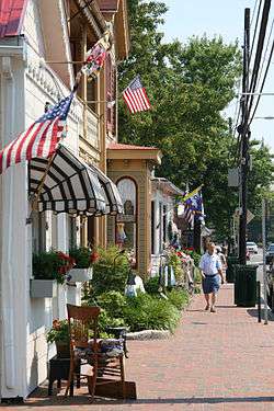
The Saint Michaels Historic District encompasses the historic center of Saint Michaels, Maryland, U.S.A. The late 18th- and early 19th-century town is a small seaport on a tributary of the Chesapeake Bay which has retained a high degree of historic integrity. Of particular interest are an unusual number of gallery-fronted houses.[2]
It was listed on the National Register of Historic Places in 1986.[1]
While writing Chesapeake, James Michener lived here, both researching for the book and experiencing life in the historic town.[3]
The principal buildings of the district are:[4]
- Cannonball House (1805), corner of Mulberry Street and St. Mary's Square;
- Bruff House (ca. 1790), Thompsons Alley;
- Leonard Funeral Home (1825-1850,with later extensions), 312 Talbot Street;
- St. Mary's Square Museum, St. Mary's Square;
- Amelia Welby House, Mulberry Street;
- Old Inn (ca. 1816), corner of Talbot and Mulberry Streets;
- Dorris House (1806), corner of Talbot and Mulberry Streets;
- St. Luke's Methodist Church (1871), Talbot Street;
- Christ Episcopal Church (1878), Talbot Street;
- Tarr House (ca. 1800-1810), 109 Green Street;
- Bruff-Mansfield House, northwest corner of Green and Locust Streets;
- Dr. Dodson House, southwest corner of Cherry and Locust Streets;
- The "Snuggery", Cherry Street;
- Henry Clay Dodson House, end of Cherry Street;
- Gingerbread House (1879), 103 Talbot Street;
- Granite Lodge (1839), 403 St. Mary's Square;
- Old Parsonage (ca. 1870), southwest corner of Talbot Street and Dodson Avenue;
- Colonel Kemp House (ca. 1805), northwest corner of Talbot and West Chestnut Streets;
- St. Michaels Mill (1890s), Chew Avenue;
- Town Hall Mall (ca 1875), west side of Talbot Street;
- Clifton Hope House (1888), 400 South Talbot Street;
- Haddaway House (1810s), Locust Street.
References
- 1 2 National Park Service (2010-07-09). "National Register Information System". National Register of Historic Places. National Park Service.
- ↑ Paul Touart (March 1986). "National Register of Historic Places Registration: St. Michaels Historic District" (PDF). Maryland Historical Trust. Retrieved 2016-03-01.
- ↑ "The Heart & Soul of the Chesapeake Bay". Boating in St. Michaels. MarinaLife. Retrieved 2008-07-19.
- ↑ "NRHP Nomination". United States Department of the Interior. Retrieved 9 November 2017.
External links
- St. Michaels Historic District, Talbot County, including photo dated 1986, at Maryland Historical Trust
- St. Michaels Historic District Boundary Map
| Topics |  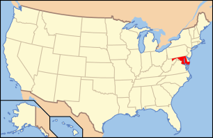 | |
|---|---|---|
| Lists by county | ||
| Lists by city | ||
| Other lists | ||
| ||
This article is issued from
Wikipedia.
The text is licensed under Creative Commons - Attribution - Sharealike.
Additional terms may apply for the media files.