St. Marys Street station
ST. MARY'S | |||||||||||
|---|---|---|---|---|---|---|---|---|---|---|---|
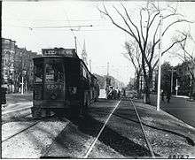
 An outbound train at St. Marys Street station in May 2011 | |||||||||||
| Location |
Beacon Street at St. Mary's Street Brookline, Massachusetts | ||||||||||
| Coordinates | 42°20′45.40″N 71°6′26.58″W / 42.3459444°N 71.1073833°WCoordinates: 42°20′45.40″N 71°6′26.58″W / 42.3459444°N 71.1073833°W | ||||||||||
| Owned by | Massachusetts Bay Transportation Authority | ||||||||||
| Line(s) |
Green Line "C" | ||||||||||
| Platforms | 2 side platforms | ||||||||||
| Tracks | 2 | ||||||||||
| Connections |
| ||||||||||
| Construction | |||||||||||
| Bicycle facilities | 10 spaces | ||||||||||
| Disabled access | Yes | ||||||||||
| History | |||||||||||
| Rebuilt | 2002 | ||||||||||
| Traffic | |||||||||||
| Passengers (2011) | 1,532 (weekday average boardings)[1] | ||||||||||
| Services | |||||||||||
| |||||||||||
St. Marys Street (signed as St. Mary's) is a surface light rail stop on the MBTA Green Line "C" Branch, located just west of the intersection of Beacon Street and Park Drive in the northeastern tip of Brookline, Massachusetts. Like all surface stops on the line, St Marys Street consists of two side platforms serving two tracks. The station is fully handicapped accessible.
With just over 1,500 daily boardings by a 2011 count, St. Marys Street is the second-busiest stop on the "C" Branch, behind only Coolidge Corner.[1]
Station layout
| G Street/ Platform level |
Side platform, doors will open on the right | |
| Outbound | ← "C" Branch toward Cleveland Circle (Hawes Street) | |
| Inbound | → "C" Branch toward North Station (Kenmore) → | |
| Side platform, doors will open on the right | ||
History and operations
St. Marys Street is the first outbound surface stop on the "C" Branch. The line emerges from the Beacon Street tunnel at the St. Marys Street portal, just east of the station. Until Kenmore was built in 1932, streetcars emerged from the Kenmore portal and ran down the median of Beacon Street from Kenmore Square.
St. Marys Street became fully handicapped accessible after work done under the Light Rail Accessibility Program in 2002.
Bus connections
No MBTA Bus routes run parallel to the line on Beacon Street. Two routes run via Park Drive, stopping just north of Beacon Street a block away from the station:
References
- 1 2 "Ridership and Service Statistics" (PDF) (14 ed.). Massachusetts Bay Transportation Authority. 2014. Retrieved 20 April 2016.
External links
| Wikimedia Commons has media related to St. Marys Street station. |