St. James, Michigan
| St. James, Michigan | |
|---|---|
| Census-designated place | |
 St. James Location within the state of Michigan | |
| Coordinates: 45°44′47″N 85°31′18″W / 45.74639°N 85.52167°WCoordinates: 45°44′47″N 85°31′18″W / 45.74639°N 85.52167°W | |
| Country | United States |
| State | Michigan |
| Counties | Charlevoix |
| Township | St. James |
| Area | |
| • Total | 1.03 sq mi (2.67 km2) |
| • Land | 1.03 sq mi (2.67 km2) |
| • Water | 0 sq mi (0 km2) |
| Elevation | 600 ft (200 m) |
| Population (2010) | |
| • Total | 205 |
| • Density | 199/sq mi (76.9/km2) |
| Time zone | UTC-5 (Eastern (EST)) |
| • Summer (DST) | UTC-4 (EDT) |
| ZIP code | 49782 |
| Area code(s) | 231 |
| FIPS code | 26-70900 |
| GNIS feature ID | 0636683[1] |
St. James is an unincorporated community and census-designated place in Charlevoix County in the U.S. state of Michigan. As of the 2010 census it had a population of 205.[2] It was the county seat of Manitou County, Michigan during the county's existence from 1855 to 1895.
Geography
St. James is located in St. James Township at the northern end of Beaver Island, the largest island in Lake Michigan. The center of town faces southeast onto St. James Harbor, through which the Beaver Island Ferry arrives from Charlevoix. The northeastern side of the entrance to the harbor is marked by the Beaver Island Harbor Light. The St. James CDP extends east about 0.5 miles (0.8 km) to Lookout Point and Sucker Point, marking the northeastern end of the island.
According to the U.S. Census Bureau, the CDP has a total area of 1.03 square miles (2.67 km2), all of it land.[2]
References
- ↑ U.S. Geological Survey Geographic Names Information System: St. James, Michigan
- 1 2 "Geographic Identifiers: 2010 Demographic Profile Data (G001): St. James CDP, Michigan". U.S. Census Bureau, American Factfinder. Retrieved September 5, 2014.
Municipalities and communities of Charlevoix County, Michigan, United States | ||
|---|---|---|
| Cities | 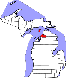 | |
| Village | ||
| Townships | ||
| CDPs | ||
| Indian reservations | ||
| Footnotes | ‡This populated place also has portions in an adjacent county or counties | |