Saint Helens, Kentucky
| Saint Helens | |
|---|---|
| Unincorporated community | |
 Saint Helens Location within the state of Kentucky  Saint Helens Saint Helens (the US) | |
| Coordinates: 37°34′58″N 83°38′50″W / 37.58278°N 83.64722°WCoordinates: 37°34′58″N 83°38′50″W / 37.58278°N 83.64722°W | |
| Country | United States |
| State | Kentucky |
| County | Lee |
| Elevation | 728 ft (222 m) |
| Time zone | UTC-5 (Eastern (EST)) |
| • Summer (DST) | UTC-4 (EDT) |
| ZIP codes | 41368 |
| GNIS feature ID | 515175 |
Saint Helens is an unincorporated community in Lee County, Kentucky, in the United States.[1] It lies along Route 52 east of the city of Beattyville, the county seat of Lee County.[2] Its elevation is 728 feet (222 m).[1] Although it is unincorporated, it has a post office, with the ZIP code of 41368.[3] This post office preëmpted the naming of a community in Jefferson County as Saint Helens; instead, it had to adopt the name "Shively" after an early settler.[4]
This Lee County community is also sometimes (unofficially) known as Three Forks.
See also
References
- 1 2 U.S. Geological Survey Geographic Names Information System: Saint Helens, Kentucky, Geographic Names Information System, 1979-09-30. Accessed 2007-12-30.
- ↑ Rand McNally. The Road Atlas '06. Chicago: Rand McNally, 2006, p. 43.
- ↑ Zip Code Lookup
- ↑ The Encyclopedia of Louisville, p. 819. "Shively". University Press of Kentucky (Lexington), 2001. Accessed 10 October 2013.
Municipalities and communities of Lee County, Kentucky, United States | ||
|---|---|---|
| City | 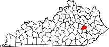 | |
| Unincorporated communities |
| |
This article is issued from
Wikipedia.
The text is licensed under Creative Commons - Attribution - Sharealike.
Additional terms may apply for the media files.