St. Bonaventure, New York
| St. Bonaventure, New York | |
|---|---|
| Census-designated place | |
 St. Bonaventure Location within the state of New York | |
| Coordinates: 42°4′49″N 78°28′30″W / 42.08028°N 78.47500°WCoordinates: 42°4′49″N 78°28′30″W / 42.08028°N 78.47500°W | |
| Country | United States |
| State | New York |
| County | Cattaraugus |
| Town | Allegany |
| Area | |
| • Total | 2.1 sq mi (5.5 km2) |
| • Land | 2.0 sq mi (5.1 km2) |
| • Water | 0.2 sq mi (0.4 km2) |
| Elevation | 1,427 ft (435 m) |
| Population (2010) | |
| • Total | 2,044 |
| • Density | 1,034/sq mi (399.4/km2) |
| Time zone | UTC-5 (Eastern (EST)) |
| • Summer (DST) | UTC-4 (EDT) |
| FIPS code | 36-64551 |
| GNIS feature ID | 1867415 |
St. Bonaventure is a hamlet and census-designated place (CDP) in the town of Allegany in Cattaraugus County, New York, United States. The population was 2,044 at the 2010 census.[1]
This community, located between the village of Allegany and the city of Olean, is established around St. Bonaventure University. Since the campus comprises the majority of the CDP, it has a much lower per capita income than most communities in the state, as do the several other CDPs statewide that are drawn around college campuses.[2] St. Bonaventure also has its own on-campus post office and ZIP code (14778), separate from Allegany and Olean's.
Geography
St. Bonaventure is located at 42°4'49" North, 78°28'30" West (42.080297, -78.474904).[3]
New York State Route 417 passes through the community, which is immediately north of the Allegheny River and south of the Southern Tier Expressway.
According to the United States Census Bureau, the CDP has a total area of 2.1 square miles (5.5 km2), of which 2.0 square miles (5.1 km2) is land and 0.15 square miles (0.4 km2), or 7.16%, is water.[1]
Demographics
As of the census[4] of 2000, there were 2,127 people, 250 households, and 153 families residing in the community. The population density was 1,047.9 per square mile (404.6/km²). There were 265 housing units at an average density of 130.6/sq mi (50.4/km²). The racial makeup of the CDP was 96.47% White, 1.83% African American, 0.33% Native American, 0.61% Asian, 0.33% from other races, and 0.42% from two or more races. Hispanic or Latino of any race were 1.50% of the population.
There were 250 households out of which 24.0% had children under the age of 18 living with them, 48.4% were married couples living together, 8.8% had a female householder with no husband present, and 38.4% were non-families. 33.2% of all households were made up of individuals and 18.8% had someone living alone who was 65 years of age or older. The average household size was 2.19 and the average family size was 2.78. In the area the population was spread out with 5.1% under the age of 18, 74.6% from 18 to 24, 6.9% from 25 to 44, 7.9% from 45 to 64, and 5.5% who were 65 years of age or older. The median age was 21 years. For every 100 females, there were 89.6 males. For every 100 females age 18 and over, there were 88.9 males.
The median income for a household in the community was $38,438, and the median income for a family was $43,542. Males had a median income of $32,292 versus $21,591 for females. The per capita income for the CDP was $7,738. About 4.8% of families and 9.0% of the population were below the poverty line, including 11.5% of those under age 18 and 7.0% of those age 65 or over.
References
- 1 2 "Geographic Identifiers: 2010 Demographic Profile Data (G001): St. Bonaventure CDP, New York". U.S. Census Bureau, American Factfinder. Retrieved October 30, 2014.
- ↑ "Selected Economic Characteristics: 2008-2012 American Community Survey 5-Year Estimates (DP03): All Places Within New York". U.S. Census Bureau, American Factfinder. Retrieved October 30, 2014.
- ↑ "US Gazetteer files: 2010, 2000, and 1990". United States Census Bureau. 2011-02-12. Retrieved 2011-04-23.
- ↑ "American FactFinder". United States Census Bureau. Retrieved 2008-01-31.
Municipalities and communities of Cattaraugus County, New York, United States | ||
|---|---|---|
| Cities | 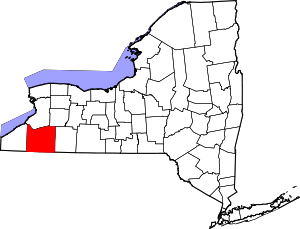 | |
| Towns |
| |
| Villages | ||
| CDPs | ||
| Other hamlets | ||
| Indian reservations | ||
| Ghost towns | ||
| Footnotes |
| |