Srpski Itebej
| Srpski Itebej Српски Итебеј | |
|---|---|
| Village | |
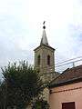
 The Orthodox Church of Saint Sava | |
 Srpski Itebej Location of Srpski Itebej within Serbia | |
| Coordinates: 45°34′07″N 20°42′29″E / 45.56861°N 20.70806°ECoordinates: 45°34′07″N 20°42′29″E / 45.56861°N 20.70806°E | |
| Country | Serbia |
| Province | Vojvodina |
| District | Central Banat |
| Elevation | 70 m (230 ft) |
| Population (2002) | |
| • Srpski Itebej | 2,405 |
| Time zone | UTC+1 (CET) |
| • Summer (DST) | UTC+2 (CEST) |
| Postal code | 23233 |
| Area code(s) | +381(0)23 |
| Car plates | ZR |
Srpski Itebej (Serbian Cyrillic: Српски Итебеј) is a village in Serbia. It is situated in the Žitište municipality, Central Banat District, Vojvodina province. The village has a Serb ethnic majority (78.21%) and a Hungarian minority (10.60%), with a population of 2,405 (2002 census).
Historical population
- 1961: 4,634
- 1971: 4,058
- 1981: 3,281
- 1991: 2,873
Gallery
 The Blessed Virgin Mary Deliverer of slaves Catholic church.
See also
References
- Slobodan Ćurčić, Broj stanovnika Vojvodine, Novi Sad, 1996.
External links
| Wikimedia Commons has media related to Srpski Itebej. |
This article is issued from
Wikipedia.
The text is licensed under Creative Commons - Attribution - Sharealike.
Additional terms may apply for the media files.