Sprouston
| Sprouston | |
|---|---|
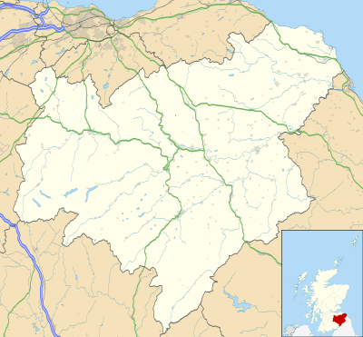 Sprouston Sprouston shown within the Scottish Borders | |
| OS grid reference | NT7584735359 |
| Council area | |
| Lieutenancy area | |
| Country | Scotland |
| Sovereign state | United Kingdom |
| Post town | Kelso |
| Postcode district | TD5 8 |
| Dialling code | 01573 |
| Police | Scottish |
| Fire | Scottish |
| Ambulance | Scottish |
| EU Parliament | Scotland |
| UK Parliament | |
| Scottish Parliament | |
Sprouston is a village and parish in the Scottish Borders area of Scotland, as well as the historic county of Roxburghshire, located 2 miles north-east of Kelso.[1]
The village is close to the south bank of the river Tweed (200 yards away[2]), which forms the northern boundary of the parish. The eastern border of the parish is also the border with England and with the parish of Carham, Northumberland in that country, Sprouston being the last Scottish parish on the south side of the Tweed. The parish of Linton borders Sprouston to the south and the parishes of Eckford and Kelso to the west. The parish forms a rough square shape about 4 miles across [2] and has an area of 8637 acres [1]
The earliest mention of this parish in an authentic document is in the foundation charter of Selkirk of 1114 and it is also mentioned in the charter given to Kelso Abbey in 1128.[2]
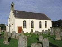
Sprouston Kirk, completed in 1781, is a replica of an older (12th Century) building which was sited nearby.[3]
Two ridges of slight gradient run across from north-east to south-west in the parish, named Hadden Rig (height 541 ft), running through the centre and Lempitlaw, sited along the southern boundary.[2] The first ridge, which has a commanding view over the Tweed, was the site of the Battle of Haddon Rig in 1542, a significant Scottish victory.
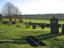
The original Lempitlaw church was a ruin by the late 18th century, although the churchyard was still in use
Lempitlaw is a hamlet in the southern part of the parish and was formerly a parish itself, the remains of its church being visible up to the late 18th century. This barony was granted by David I to Richard Germyn.[4] In the 19th century it was a barony in the possession of the Duke of Buccleuch, while the remaining area, the original parish of Sprouston, belonged to the Duke of Roxburghe,[2] whose seat is at Floors Castle nearby.
Within the parish on the eastern side is Holefield. This farm was the birthplace and childhood of Scottish Border poet and Australian bush balladeer Will H. Ogilvie (1869–1963) before he went to Australia in 1889. The Ogilvie family had provided over three hundred years of managing estates in the Borders area, the most recently then in the service to the Duke of Buccleuch.[5][6] His poems and subjects included Border life and locales, such as the nearby Bowmont Water, and Cheviot Hills (Home):
- I hear the plough's creak, and the trampling Clydes,
- The bicker of the darting gulls above the new-turned loam,
- And the March wind from Cheviot roaring as he rides
- Down the ribboned leas of Home.
The Tweedmouth to Sprouston branch railway opened in 1849, when Sprouston station served as the station for Kelso. Sprouston railway station was closed to passengers in 1955 [7] and the line was closed in 1968.[8]
Sprouston Community Council covers roughly the same area as the civil parish.[9]
References
- 1 2 Survey Gazetteer of the British Isles, publ. J.G. Bartholomew, 1904, p. 746
- 1 2 3 4 5 New Statistical Account of Scotland, Vol III Roxburgh, Peebles, Selkirk, publ.William Blackwood, 1845 pp.235-240
- ↑ Church of Scotland web site: http://www.kelsolinkedchurchescofs.org/sproutston-history retrieved Feb 2014
- ↑ History and Antiquities of Roxburghshire, by Alexander Jeffrey, publ. Jedburgh 1855; Vol 3, p 204
- ↑ Semmler, Clement (1988). "Ogilvie, William Henry (Will) (1869–1963)". Australian Dictionary of Biography. Australian National University. Retrieved 18 October 2017.
- ↑ "William Henry Ogilvie 1869-1963". Biographies of Characters with Kelso Connections. Kelso Connections. 2015. Retrieved 18 February 2018.
- ↑ The Berwick Advertiser: 2 June 1955
- ↑ David Ross, The North British Railway: A History, Stenlake Publishing Limited, Catrine, 2014, ISBN 978 1 84033 647 4
- ↑ Community Council http://www.scotborders.gov.uk/downloads/file/2303/sprouston_community_council_boundary_map retrieved Feb 2016