Carham
| Carham | |
|---|---|
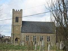 St Cuthbert's church | |
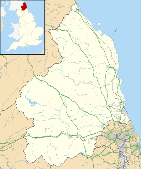 Carham Carham shown within Northumberland | |
| Population | 346 (2011 census)[1] |
| OS grid reference | NT795385 |
| District | |
| Shire county | |
| Region | |
| Country | England |
| Sovereign state | United Kingdom |
| Post town | CORNHILL-ON-TWEED |
| Postcode district | TD12 |
| Dialling code | 01890 |
| Police | Northumbria |
| Fire | Northumberland |
| Ambulance | North East |
| EU Parliament | North East England |
| UK Parliament | |
Carham or Carham on Tweed is a village in Northumberland, England. The village lies on the south side of the River Tweed about 3 miles (5 km) west of Coldstream. According to the United Kingdom Census 2011, it is the place in England with greatest proportion of Scottish-born people, at approximately 33%.
Etymology
Carham has generally been etymologised as an Old English place-name. The first syllable would be from carr 'rock', and the second either a dative plural ending (the whole name having been carrum '(at the) rocks') or the word hām ('homestead'). However, the twelfth-century chronicler Richard of Hexham appears not to have considered the name an English one, so it may actually come from Cumbric *kair 'fortification'.[2]
History
Near to Carham are the extensive remains of Early British camps and a bronze sword, now in the British Museum, discovered in the nearby Tweed.[3]
Carham on the Tweed, where a stream divides Northumberland from Scotland, was the scene of two battles in Anglo-Saxon times.[4]
In 833 the Danes fought the English, and the English were routed. Leland tells us that
in the 33rd year of Ecbright the Danes arrived at Lindisfarne and fought with the English at Carham where Eleven Bishops and two English Countes were slayne, and a great numbre of people.
A field between the glebe and Dunstan Wood, where bones have been from time to time disinterred, is probably the site of the battle.[3][5]
In 1016 or 1018 the Battle of Carham between the Kingdom of Scotland and the Northumbrians resulted in a Scottish victory.
Governance
Carham is in the parliamentary constituency of Berwick-upon-Tweed.
Religious sites
The church is dedicated to St Cuthbert.[6]
References
- ↑ "Parish population 2011". Retrieved 3 July 2015.
- ↑ Bethany Fox, 'The P-Celtic Place-Names of North-East England and South-East Scotland', The Heroic Age, 10 (2007), http://www.heroicage.org/issues/10/fox.html (appendix at http://www.heroicage.org/issues/10/fox-appendix.html).
- 1 2 Ridley, Nancy (1966). Portrait of Northumberland (reprint ed.). London: Robert Hale. OCLC 503957631.
- ↑ British History Online
- ↑ Hugill, Robert (1931). Road Guide to Northumberland and The Border. Newcastle upon Tyne, England: Andrew Reid & Company, Limited.
- ↑ Purves, Geoffrey (2006). Churches of Newcastle and Northumberland. Stroud, Gloucestershire, England: Tempus Publishing Limited. p. 173. ISBN 0 7524 4071 3. Archived from the original on 2016-01-13.
External links
| Wikimedia Commons has media related to Carham. |
- The Official Carham Parish Website
- GENUKI (accessed: 19 November 2008)