Spottsville, Kentucky
| Spottsville, Kentucky | |
|---|---|
| Census-designated place | |
 Spottsville  Spottsville | |
| Coordinates: 37°51′27″N 87°24′49″W / 37.85750°N 87.41361°WCoordinates: 37°51′27″N 87°24′49″W / 37.85750°N 87.41361°W | |
| Country | United States |
| State | Kentucky |
| County | Henderson |
| Area | |
| • Total | 0.48 sq mi (1.24 km2) |
| • Land | 0.47 sq mi (1.22 km2) |
| • Water | 0.008 sq mi (0.02 km2) |
| Elevation | 397 ft (121 m) |
| Population (2010) | |
| • Total | 325 |
| • Density | 690/sq mi (266.3/km2) |
| Time zone | UTC-6 (Central (CST)) |
| • Summer (DST) | UTC-5 (CST) |
| ZIP code | 42458 |
| FIPS code | 21-72570 |
| GNIS feature ID | 504091[1] |
Spottsville is a census-designated place (CDP) and former coal town in Henderson County, Kentucky, United States. As of the 2010 census the population was 325.[2]
U.S. Route 60 forms the northern edge of Spottsville, and the Green River forms the eastern edge. The Green River Lock & Dam is located in the community. If one travels east through Spottsville, one can see the lock to one's right when one crosses the US-60 bridge (the Green River Bridge). One can still see some of the remains of the old locks that were replaced in the mid-1960s; to one's left, one can see a turning bridge for trains (it turns when a barge comes through).
US-60 leads east 19 miles (31 km) to Owensboro and west 11 miles (18 km) to Henderson, the Henderson County seat.
There is one elementary school in Spottsville, serving all of the eastern part of Henderson County (including Beals, Baskett, and Reed). The original Spottsville school, which served all grades, provided Henderson County's first school bus service in 1920. This original Spottsville school burned down in March 1932.
Spottsville was named for Major Samuel Spotts, who shot the first gun at the Battle of New Orleans. The area was visited by the Spanish explorer Hernando de Soto in 1541. His army was attacked near the Ohio River by Indians of a tribe or tribes called variously the Kashinampo, the Quizqui, and the Chiska Cherokee.
From 1904 to 1911 as many as 116 men of the Green River Coal Company mined coal in Spottsville. The Pittsburg Coal Company operated a 75-man coal camp in Spottsville from 1911 to 1924.[3]
References
- ↑ U.S. Geological Survey Geographic Names Information System: Spottsville, Kentucky
- ↑ "Geographic Identifiers: 2010 Demographic Profile Data (G001): Spottsville CDP, Kentucky". American Factfinder. U.S. Census Bureau. Retrieved June 30, 2017.
- ↑ "Kentucky Coal Heritage - Henderson County, Kentucky Coal Camps". Coaleducation.org. Retrieved April 8, 2013.
External links
Municipalities and communities of Henderson County, Kentucky, United States | ||
|---|---|---|
| Cities | 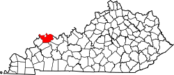 | |
| CDPs | ||
| Other communities | ||
| Ghost town | ||
| Footnotes | ‡This populated place also has portions in an adjacent county or counties | |