Spillville, Iowa
| Spillville, Iowa | |
|---|---|
| City | |
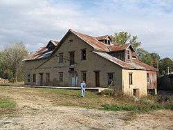 Spillville Mill, demolished 2011 | |
 Location of Spillville, Iowa | |
| Coordinates: 43°12′N 91°57′W / 43.200°N 91.950°WCoordinates: 43°12′N 91°57′W / 43.200°N 91.950°W | |
| Country |
|
| State |
|
| County | Winneshiek |
| Area[1] | |
| • Total | 0.43 sq mi (1.11 km2) |
| • Land | 0.42 sq mi (1.09 km2) |
| • Water | 0.01 sq mi (0.03 km2) |
| Elevation | 1,070 ft (326 m) |
| Population (2010)[2] | |
| • Total | 367 |
| • Estimate (2016)[3] | 350 |
| • Density | 874/sq mi (337.4/km2) |
| Time zone | UTC-6 (Central (CST)) |
| • Summer (DST) | UTC-5 (CDT) |
| ZIP code | 52168 |
| Area code(s) | 563 |
| FIPS code | 19-74370 |
| GNIS feature ID | 0461848 |
Spillville Fireworks are held the first Saturday in July, Spillville, Iowa is famously known for its Independence Day (July 4th) fireworks display. Spillville is a city in Winneshiek County, Iowa, United States. The population was 367 at the 2010 census. It is located in Calmar Township, about 4 mi (6.4 km) west of Calmar and about 12 miles (19 km) southwest of Decorah, the county seat.
History
Spillville was platted by German Joseph Spielmann in 1860.[4]
It was largely settled by Bohemian, German and Swiss immigrants.
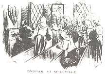
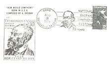
Spillville boasts a strong cultural and musical history. The Czech composer Antonín Dvořák spent the summer of 1893 in Spillville, where his friend Josef Jan Kovařík had relatives. There he composed two of his most famous chamber works: the String Quartet in F ("The American") and the String Quintet in E-flat. Spillville is also the site of the Inwood Ballroom, established in 1920 and the destination of several popular 20th-century musicians such as Louis Armstrong, Glenn Miller, Guy Lombardo, and The Byrds. Many tourists to Spillville have also visited the Bily Clock Museum (see link below), a collection of intricately designed clocks created by two brothers in Spillville.
The Roman Catholic parish in Spillville, St. Wenceslaus Church, was built in 1860 and is the oldest Czech Catholic church in the United States. Originally named Spielville after the founder, Joseph Spielman, it was misread and became Spillville.
Geography
Spillville is located at 43°12′N 91°57′W / 43.20°N 91.95°W (43.202, -91.952).[5]
According to the United States Census Bureau, the city has a total area of 0.43 square miles (1.11 km2), of which, 0.42 square miles (1.09 km2) is land and 0.01 square miles (0.03 km2) is water.[1]
Demographics
| Historical populations | ||
|---|---|---|
| Year | Pop. | ±% |
| 1900 | 356 | — |
| 1910 | 320 | −10.1% |
| 1920 | 315 | −1.6% |
| 1930 | 304 | −3.5% |
| 1940 | 329 | +8.2% |
| 1950 | 363 | +10.3% |
| 1960 | 389 | +7.2% |
| 1970 | 361 | −7.2% |
| 1980 | 415 | +15.0% |
| 1990 | 387 | −6.7% |
| 2000 | 386 | −0.3% |
| 2010 | 367 | −4.9% |
| 1880 | 340 | −7.4% |
| 2016 | 350 | +2.9% |
| Source:"American FactFinder". United States Census Bureau.
and Iowa Data Center Source: | ||
2010 census
As of the census[2] of 2010, there were 367 people, 168 households, and 96 families residing in the city. The population density was 873.8 inhabitants per square mile (337.4/km2). There were 182 housing units at an average density of 433.3 per square mile (167.3/km2). The racial makeup of the city was 96.5% White, 0.3% African American, 0.3% Native American, and 3.0% from other races. Hispanic or Latino of any race were 3.3% of the population.
There were 168 households of which 26.8% had children under the age of 18 living with them, 50.6% were married couples living together, 4.2% had a female householder with no husband present, 2.4% had a male householder with no wife present, and 42.9% were non-families. 35.7% of all households were made up of individuals and 21.4% had someone living alone who was 65 years of age or older. The average household size was 2.18 and the average family size was 2.90.
The median age in the city was 42.8 years. 22.3% of residents were under the age of 18; 5.9% were between the ages of 18 and 24; 23.2% were from 25 to 44; 23.3% were from 45 to 64; and 25.1% were 65 years of age or older. The gender makeup of the city was 50.7% male and 49.3% female.
2000 census
As of the census[7] of 2000, there were 386 people, 172 households, and 110 families residing in the city. The population density was 920.8 people per square mile (354.8/km2). There were 184 housing units at an average density of 438.9 per square mile (169.1/km2). The racial makeup of the city was 98.70% White, 0.78% Native American, 0.26% Asian, 0.26% from other races. Hispanic or Latino of any race were 1.55% of the population.
There were 172 households out of which 29.7% had children under the age of 18 living with them, 55.2% were married couples living together, 7.6% had a female householder with no husband present, and 35.5% were non-families. 32.0% of all households were made up of individuals and 20.3% had someone living alone who was 65 years of age or older. The average household size was 2.24 and the average family size was 2.85.
24.6% are under the age of 18, 5.7% from 18 to 24, 28.5% from 25 to 44, 18.4% from 45 to 64, and 22.8% who were 65 years of age or older. The median age was 38 years. For every 100 females, there were 96.9 males. For every 100 females age 18 and over, there were 94.0 males.
The median income for a household in the city was $32,500, and the median income for a family was $41,563. Males had a median income of $30,909 versus $20,938 for females. The per capita income for the city was $15,674. About 5.0% of families and 6.9% of the population were below the poverty line, including 4.3% of those under age 18 and 20.5% of those age 65 or over.
Parks
- Riverside Park & the Inwood Pavilion
References
- 1 2 "US Gazetteer files 2010". United States Census Bureau. Archived from the original on 2012-07-14. Retrieved 2012-05-11.
- 1 2 "American FactFinder". United States Census Bureau. Retrieved 2012-05-11.
- ↑ "Population and Housing Unit Estimates". Retrieved June 9, 2017.
- ↑ Bailey, Edwin C. (1913). Past and Present of Winneshiek County, Iowa: A Record of Settlement, Organization, Progress and Achievement. S. J. Clarke Publishing Co. p. 205.
- ↑ "US Gazetteer files: 2010, 2000, and 1990". United States Census Bureau. 2011-02-12. Retrieved 2011-04-23.
- ↑ "Census of Population and Housing". Census.gov. Retrieved June 4, 2015.
- ↑ "American FactFinder". United States Census Bureau. Retrieved 2008-01-31.
External links
Municipalities and communities of Winneshiek County, Iowa, United States | ||
|---|---|---|
| Cities | ||
| Townships | ||
| CDP | ||
| Unincorporated community | ||
| Ghost town | ||