Spildra
 Village of Dunvika on Spildra (looking to the mainland to the west) | |
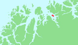 | |
 Spildra Location of the island  Spildra Spildra (Norway) | |
| Geography | |
|---|---|
| Location | Troms, Norway |
| Coordinates | 70°01′14″N 21°37′52″E / 70.0206°N 21.6311°ECoordinates: 70°01′14″N 21°37′52″E / 70.0206°N 21.6311°E |
| Area | 21.4 km2 (8.3 sq mi) |
| Length | 6.5 km (4.04 mi) |
| Width | 4.5 km (2.8 mi) |
| Highest elevation | 444 m (1,457 ft) |
| Highest point | Raideren |
| Administration | |
|
Norway | |
| County | Troms |
| Municipality | Kvænangen Municipality |
| Demographics | |
| Population | 2017 (26) |
Spildra (Norwegian) or Spittá (Northern Sami) is an island in Kvænangen Municipality in Troms county, Norway. The 21.4-square-kilometre (8.3 sq mi) island lies in the middle of the Kvænangen fjord, about 5 kilometres (3.1 mi) north of the island of Skorpa. The island has a population (2017) of 26 people, with everyone living along the southern coast. The only access to the island is by boat. The population has been declining over time. The main economic activities on the island center around the production of Boknafisk as well as tourism.[1]
See also
References
- ↑ Thorsnæs, Geir, ed. (2018-03-28). "Spildra". Store norske leksikon (in Norwegian). Kunnskapsforlaget. Retrieved 2018-08-02.
This article is issued from
Wikipedia.
The text is licensed under Creative Commons - Attribution - Sharealike.
Additional terms may apply for the media files.