Southwick, Wiltshire
| Southwick | |
|---|---|
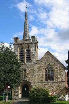
 Parish church of St. Thomas | |
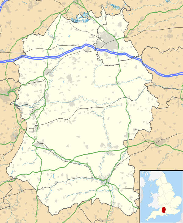
 Southwick Southwick shown within Wiltshire | |
| Population | 1,953 (2011 census)[1] |
| OS grid reference | ST837552 |
| Civil parish |
|
| Unitary authority | |
| Ceremonial county | |
| Region | |
| Country | England |
| Sovereign state | United Kingdom |
| Post town | Trowbridge |
| Postcode district | BA14 |
| Dialling code | 01225 |
| Police | Wiltshire |
| Fire | Dorset and Wiltshire |
| Ambulance | South Western |
| EU Parliament | South West England |
| UK Parliament | |
| Website | Parish Council |
Southwick is a semi-rural village and civil parish 3 miles (4.8 km) southwest of the county town of Trowbridge, Wiltshire, England. It is separated from the southwest fringe of Trowbridge only by the Southwick Country Park, which consists of 380 acres (150 ha) of open fields. The majority of the village lies south of the A361, which runs through the village, linking Trowbridge with Frome. The Somerset border lies approximately one mile to the southwest on the A361, with the closest villages being Rode, one mile to the southwest, and North Bradley, one mile to the southeast.
The parish includes the hamlets of Hoggington and Hoopers Pool.
History
Southwick Court Farmhouse, northwest of the village, is an L-shaped house of which one wing is dated 1567;[2] its gatehouse and bridge are Grade II* listed.[3] Brook House, southeast of the village, is a 17th-century farmhouse beside an early 16th-century stone-built range.[2] The Poplars was built in about 1650 and re-faced with brick in about 1700.[2] Manor Farmhouse, west of the village, was built in 1673.[2]
The Baptist chapel was built in 1815.[4] The Church of England parish church of Saint Thomas was built in 1899–1904 to designs by the Gothic Revival architect C.E. Ponting of Marlborough.[4]
Until 1866 Southwick was part of North Bradley parish.[5]
Governance
The civil parish elects a parish council. It is in the area of Wiltshire Council unitary authority, which is responsible for all significant local government functions.
An electoral ward in the same name exists. The ward starts in the west at Southwick and then stretches east to West Ashton. The total ward population taken from the 2011 census was 4,444.[6]
Amenities
The village has a small primary school[7] which is located next to a large playing field.
There are two main residential areas in the northeast of the village, opposite the Southwick Allotments and the 'Farmhouse Inn' pub. The estates are linked, and named Chantry Gardens and Fleur De Lys Drive. In 2011, a small cluster of houses was built north of Fleur De Lys Drive, linked to Fleur De Lys Drive via a short path; this development was named Greenleaze Close. The second large group of housing is located to the south and west of the playing field, and has short roads branching off Blind Lane and Wesley Lane (a road winding from Wynsome Street, between the A361 and North Bradley). These roads are named Southfield, Wesley Close and Orchard Drive. Housing was also developed off Church Street in the mid-2000s, designated The Mowlems and Swan Court.
References
- ↑ "Parish population 2011". Office for National Statistics. Retrieved 15 March 2015.
- 1 2 3 4 Pevsner & Cherry, 1975, page 474
- ↑ Historic England. "Gatehouse and bridge over moat at Southwick Court Farmhouse (1021848)". National Heritage List for England. Retrieved 2 May 2015.
- 1 2 Pevsner & Cherry, 1975, page 473
- ↑ "Southwick". Wiltshire Community History. Wiltshire Council. Retrieved 2 May 2015.
- ↑ "Ward population 2011". Office for National Statistics. Retrieved 15 March 2015.
- ↑ "Southwick C of E Primary School". Retrieved 2 May 2015.
Sources
- Pevsner, Nikolaus; Cherry, Bridget (revision) (1975). The Buildings of England: Wiltshire. Harmondsworth: Penguin Books. pp. 473–474. ISBN 0 14 071026 4.
External links
- "Victoria County History - Wiltshire - Vol 8 pp218-234 - North Bradley". British History Online. University of London. Retrieved 2 May 2015.
- "Southwick Parish Council". Retrieved 15 September 2015.
- "Southwick Village Website". Southwick Village Website. Retrieved 1 July 2015.
