South West Township, Barton County, Missouri
| South West Township | |
|---|---|
| Township | |
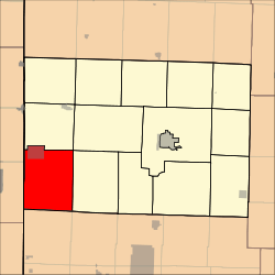 Location in Barton County | |
| Coordinates: 37°26′25″N 094°34′26″W / 37.44028°N 94.57389°WCoordinates: 37°26′25″N 094°34′26″W / 37.44028°N 94.57389°W | |
| Country | United States |
| State | Missouri |
| County | Barton |
| Area | |
| • Total | 52.04 sq mi (134.77 km2) |
| • Land | 51.78 sq mi (134.1 km2) |
| • Water | 0.26 sq mi (0.67 km2) 0.5% |
| Elevation | 958 ft (292 m) |
| Population (2000) | |
| • Total | 669 |
| • Density | 12.9/sq mi (5/km2) |
| GNIS feature ID | 0766287 |
South West Township is a township in Barton County, Missouri, USA. As of the 2000 census, its population was 669.
South West Township lies in the southwestern corner of Barton County, hence the name.[1]
Geography
South West Township covers an area of 52.04 square miles (134.8 km2) and contains one incorporated settlement, Mindenmines. According to the USGS, it contains one cemetery, Mindenmines.
The stream of Glendale Fork runs through this township.
References
- ↑ "Barton County Place Names, 1928-1945 (archived)". The State Historical Society of Missouri. Archived from the original on 24 June 2016. Retrieved 31 August 2016.
External links
Municipalities and communities of Barton County, Missouri, United States | ||
|---|---|---|
| Cities | 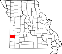 | |
| Villages | ||
| Townships | ||
| CDP | ||
| Other unincorporated communities | ||
| Ghost towns | ||
This article is issued from
Wikipedia.
The text is licensed under Creative Commons - Attribution - Sharealike.
Additional terms may apply for the media files.