Ozark Township, Barton County, Missouri
| Ozark Township | |
|---|---|
| Township | |
 Location in Barton County | |
| Coordinates: 37°33′09″N 094°32′00″W / 37.55250°N 94.53333°WCoordinates: 37°33′09″N 094°32′00″W / 37.55250°N 94.53333°W | |
| Country | United States |
| State | Missouri |
| County | Barton |
| Area | |
| • Total | 38.55 sq mi (99.84 km2) |
| • Land | 38.36 sq mi (99.35 km2) |
| • Water | 0.19 sq mi (0.5 km2) 0.5% |
| Elevation | 889 ft (271 m) |
| Population (2000) | |
| • Total | 1,102 |
| • Density | 28.7/sq mi (11.1/km2) |
| GNIS feature ID | 0766285 |
Ozark Township is a township in Barton County, Missouri, USA. As of the 2000 census, its population was 1,102.
The township takes its name from the Ozark Mountains.[1]
Geography
Ozark Township covers an area of 38.55 square miles (99.8 km2) and contains two incorporated settlements: Burgess and Liberal. According to the USGS, it contains two cemeteries: Liberal and Yale.
The streams of East Drywood Creek, Fleck Creek and Second Nicolson Creek run through this township.
References
- ↑ "Barton County Place Names, 1928-1945 (archived)". The State Historical Society of Missouri. Archived from the original on 24 June 2016. Retrieved 31 August 2016.
External links
Municipalities and communities of Barton County, Missouri, United States | ||
|---|---|---|
| Cities | 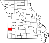 | |
| Villages | ||
| Townships | ||
| CDP | ||
| Other unincorporated communities | ||
| Ghost towns | ||
This article is issued from
Wikipedia.
The text is licensed under Creative Commons - Attribution - Sharealike.
Additional terms may apply for the media files.