South Van Horn, Alaska
| South Van Horn | |
|---|---|
| CDP | |
 Van Horn Road westbound at South Cushman Street in June 2012. In the background is a portion of the business district which runs along the CDP's northern edge. | |
| Country | United States |
| State | Alaska |
| Borough | Fairbanks North Star Borough |
| Government | |
| • Borough mayor | Karl Kassel |
| • State senator | Click Bishop (R) |
| • State rep. | Adam Wool (D) |
| Area | |
| • Total | 8.52 sq mi (22.07 km2) |
| • Land | 8.04 sq mi (20.82 km2) |
| • Water | 0.48 sq mi (1.24 km2) |
| Elevation | 418 ft (127.4 m) |
| Population (2010) | |
| • Total | 558 |
| • Density | 65.42/sq mi (25.26/km2) |
| Time zone | UTC-9 (Alaska (AKST)) |
| • Summer (DST) | UTC-8 (AKDT) |
South Van Horn is a census-designated place (CDP) in the Fairbanks North Star Borough, Alaska, United States. At the 2010 census the population was 558, the 107th largest city or CDP in Alaska.[1][2] It has a population density of 65.42 people per sq mi (25.26 per km2).[1][2]
Geography
South Van Horn is located at 64°48′34″N 147°47′17″W / 64.80944°N 147.78806°W.[3]
The CDP has a total area of 8.52 sq mi (22.07 km2), of which, 8.04 sq mi (20.82 km2) of it is land and 0.48 sq mi (1.24 km2) of it (5.68%) is water.[1][3]
The elevation is 418 ft.[1]
Demographics
South Van Horn has a median age of 42.4, with a married population of 49.3%. The average household has 2.51 people. The unemployment rate is 5.5% and the median household income is $39,883.[1][4]
References
- 1 2 3 4 5 "South Van Horn, AK - USA.com™". www.usa.com. Retrieved 2015-07-19.
- 1 2 Branch, Geographic Products. "Gazetteer Files - Geography - U.S. Census Bureau". www.census.gov. Retrieved 2015-07-19.
- 1 2 "How much do you know about your county?". County Explorer. Retrieved 2015-07-19.
- ↑ "Best Places to Live in South Van Horn, Alaska". www.bestplaces.net. Retrieved 2015-07-19.
Municipalities and communities of Fairbanks North Star Borough, Alaska, United States | ||
|---|---|---|
| Cities | 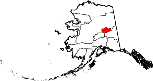 | |
| CDPs | ||
| Unincorporated communities | ||
| Ghost town | ||
This article is issued from
Wikipedia.
The text is licensed under Creative Commons - Attribution - Sharealike.
Additional terms may apply for the media files.