South San Jose
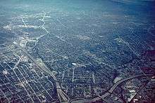
Aerial view of South San José.
| South San Jose | |
|---|---|
| Nickname(s): "South Side", "South Central" | |
| Population | |
| • Total | +406,000[1][2][3][4][5][6] |
| Area code(s) | 95111, 95119, 95120, 95123, 95136, 95138, 95139, 95193 |
South San Jose (or the South Side; less commonly South Central) is the name for a large geographic and cultural portion of San Jose, California, lying south of downtown. The name "South Side" refers to an area bounded roughly by Hillsdale Avenue, Almaden Expressway toward Happy Hollow Park & Zoo on the north, Highway 101 and Hellyer Avenue on the east, the border with the city of Morgan Hill towards the south, and Camden Avenue to the west.[7]
Neighborhoods
Neighborhoods in South San Jose include:
Light rail stations
Parks and trails
Major highways
See also
References
- ↑ https://www.point2homes.com/US/Neighborhood/CA/Santa-Clara-County/San-Jose/Silver-Creek-Demographics.html
- ↑ https://www.point2homes.com/US/Neighborhood/CA/San-Jose/Almaden-Valley-Demographics.html
- ↑ https://www.google.com/search?rlz=1C1CHBF_enUS799US799&ei=4ppbW_PMM-eF0wKOkLu4AQ&q=Blossom+Valley%2C+San+Jose+popualtion&oq=Blossom+Valley%2C+San+Jose+popualtion&gs_l=psy-ab.3..33i21k1j33i160k1.5034.7239.0.7342.11.11.0.0.0.0.179.1226.5j6.11.0....0...1c.1.64.psy-ab..0.11.1222...0j38j0i22i30k1j33i13i21k1.0.ZUXWHzV5-9o
- ↑ https://statisticalatlas.com/neighborhood/California/San-Jose/Edenvale-Seven-Trees/Population
- ↑ https://www.point2homes.com/US/Neighborhood/CA/Santa-Clara-County/San-Jose/Edenvale-Demographics.html
- ↑ https://www.point2homes.com/US/Neighborhood/CA/Santa-Clara-County/San-Jose/Santa-Teresa-Demographics.html
- ↑ "South San Jose, San Jose, CA". Google Maps. Retrieved 30 March 2018.
Coordinates: 37°14′19″N 121°50′18″W / 37.238635°N 121.838336°W
This article is issued from
Wikipedia.
The text is licensed under Creative Commons - Attribution - Sharealike.
Additional terms may apply for the media files.