South Poso Kota
| South Poso Kota Poso Kota Selatan | |
|---|---|
| Subdistrict | |
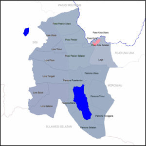 South Poso Kota highlighted in pink | |
| Coordinates: 1°23′54″S 120°46′10″E / 1.39833°S 120.76944°ECoordinates: 1°23′54″S 120°46′10″E / 1.39833°S 120.76944°E | |
| Country |
|
| Province | Central Sulawesi |
| Regency | Poso Regency |
| Government | |
| • Camat | Asmawati Gume[1] |
| Population (2015) | |
| • Total | 10,123 |
| • Density | 950/sq mi (366/km2) |
| Area code(s) | 72.02.21 |
South Poso Kota is a subdistrict in Indonesia. It is located in the Poso Regency of Central Sulawesi. Along with the neighboring districts of Poso Kota and North Poso Kota, this district make up the capital region of Poso Regency, Poso.
With the population of 10123 inhabitants and a population density of 366 km/², South Poso Kota is the 11th most populous and 3rd most densely subdistrict in Poso Regency.[2][3] With an area of 27,62 km/², South Poso Kota is one the smallest subdistrict, with a percentage of only 0.32% of the total area of Poso.[4]
Administrative division
As of 2017, South Poso Kota subdistrict consists of 5 administrative villages,[5][6] namely:
- Bukit Bambu
- Kawua
- Lembomawo
- Ranononcu
- Sayo
References
Further reading
- BPS (2016). Kabupaten Poso dalam Angka 2016 - Poso Regency in Figures 2016 (PDF) (in Indonesian). Poso: Central Bureau of Statistics of Poso Regency. Archived from the original (PDF) on August 28, 2016.
- BPS South Poso Kota (2016). "Kecamatan Poso Kota Selatan dalam Angka 2016 - South Poso Kota Subdistrict in Figures 2016" (PDF) (in Indonesian). Poso: Central Bureau of Statistics of Poso Regency.
This article is issued from
Wikipedia.
The text is licensed under Creative Commons - Attribution - Sharealike.
Additional terms may apply for the media files.