South Maroota, New South Wales
| South Maroota New South Wales | |||||||||||||||
|---|---|---|---|---|---|---|---|---|---|---|---|---|---|---|---|
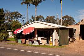 Store in South Maroota | |||||||||||||||
|
South Maroota | |||||||||||||||
| Coordinates | 33°31′27″S 150°56′55″E / 33.52417°S 150.94861°ECoordinates: 33°31′27″S 150°56′55″E / 33.52417°S 150.94861°E | ||||||||||||||
| Population | 507 (2011 census)[1] | ||||||||||||||
| Postcode(s) | 2756 | ||||||||||||||
| Location | 72 km (45 mi) northwest of Sydney CBD | ||||||||||||||
| LGA(s) | The Hills Shire | ||||||||||||||
| State electorate(s) | Hawkesbury | ||||||||||||||
| Federal Division(s) | Berowra | ||||||||||||||
| |||||||||||||||
South Maroota is a suburb in Sydney, New South Wales, Australia 72 kilometres north-west of the Sydney central business district in the local government area of The Hills Shire. The Hawkesbury River forms part of its western boundary.
Heritage listings
South Maroota has a number of heritage-listed sites, including:
- Wisemans Ferry Road: Great Drain[2]
Recreation
South Maroota contains the Pacific Park motocross and water-skiing park, on the bank of the Hawkesbury River.
References
- ↑ Australian Bureau of Statistics (31 October 2012). "South Maroota (State Suburb)". 2011 Census QuickStats. Retrieved 27 April 2015.

- ↑ "Great Drain and two house sites, New South Wales State Heritage Register (NSW SHR) Number H01402". New South Wales State Heritage Register. Office of Environment and Heritage. Retrieved 18 May 2018.
External links
This article is issued from
Wikipedia.
The text is licensed under Creative Commons - Attribution - Sharealike.
Additional terms may apply for the media files.