South Malawi montane forest-grassland mosaic
The South Malawi montane forest-grassland mosaic is an ecoregion of Malawi.
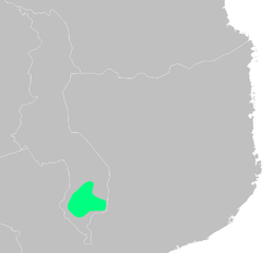
The ecoregion covers a region of highlands and plateaus that includes Mount Mulanje in the southeast and the lower Shire Highlands to the northeast and east, with the Tuchila Plain between them. The Shire Highlands includes the Zomba Plateau in the north and the Thyolo Mountains (1,462 m) to the south.
The low valley of the Shire River, part of the African Rift Valley system, bounds the Shire Highlands to the northwest, west, and southwest. The valley of the Ruo River, a tributary of the Shire, bounds the ecoregion on the south and southeast. The Phalombe Plain and the valley of Lake Chilwa lie to the northeast.[1]
The ecoregion enjoyed lush forests, fertile soils, ample water, and mild climate, and is one of the most densely populated regions of Malawi. Blantyre, Malawi's second-largest city, is in the Shire Highlands. Tea is grown commercially in the highlands, especially around Thyolo and Mulanje, and is one of Malawi's chief exports.
Protected areas
Protected areas in the ecoregion include:
External links
- "South Malawi montane forest-grassland mosaic". Terrestrial Ecoregions. World Wildlife Fund.
References
- ↑ "South Malawi montane forest-grassland mosaic". World Wildlife Fund. Accessed 23 June 2018.