South Carolina Highway 172
| ||||
|---|---|---|---|---|
 | ||||
| Route information | ||||
| Maintained by SCDOT | ||||
| Length | 9.00 mi[1] (14.48 km) | |||
| Major junctions | ||||
| West end |
| |||
|
| ||||
| East end |
| |||
| Location | ||||
| Counties | Orangeburg, Calhoun | |||
| Highway system | ||||
| ||||

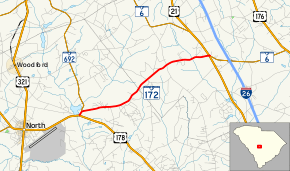
South Carolina Highway 172 (SC 172) is a nine-mile-long (14 km) state highway in the U.S. state of South Carolina. The highway travels through rural areas of Orangeburg and Calhoun counties.
Route description
SC 172 begins at an intersection with U.S. Route 178 (US 178; North Road) east-northeast of North, within Orangeburg County. This intersection also marks the terminus of SC 692, which begins a very brief concurrency with SC 172. They travel to the north-northeast. Approximately 1,000 feet (300 m) later, they split, with SC 172 heading to the east-northeast before it enters Calhoun County. It passes by the Do-Little Field airport just before it meets US 21 (Columbia Road). SC 172 continues another 0.09 miles (0.14 km) to end at SC 6 (Caw Caw Road).[2]
Major intersections
| County | Location | mi[1] | km | Destinations | Notes |
|---|---|---|---|---|---|
| Orangeburg | | 0.00 | 0.00 | Termini of SC 172 and SC 692; western end of SC 692 concurrency | |
| | 0.23 | 0.37 | Eastern end of SC 692 concurrency | ||
| Calhoun | | 8.91 | 14.34 | ||
| | 9.00 | 14.48 | |||
1.000 mi = 1.609 km; 1.000 km = 0.621 mi
| |||||
See also


References
- 1 2 "Statewide Highways (shapefile)" (zip). South Carolina Department of Transportation. September 29, 2017. Retrieved December 8, 2017.
- ↑ Google (May 20, 2018). "South Carolina Highway 172" (Map). Google Maps. Google. Retrieved May 20, 2018.
External links

- SC 172 South Carolina Hwy Index
This article is issued from
Wikipedia.
The text is licensed under Creative Commons - Attribution - Sharealike.
Additional terms may apply for the media files.