Souris Island
| Native name: Ile aux Souris Nickname: Rat Island | |
|---|---|
 Souris Island | |
| Geography | |
| Location | Seychelles, Indian Ocean |
| Coordinates | 4°37′S 55°30′E / 4.617°S 55.500°ECoordinates: 4°37′S 55°30′E / 4.617°S 55.500°E |
| Archipelago | Inner Islands, Seychelles |
| Adjacent bodies of water | Indian Ocean |
| Total islands | 1 |
| Major islands |
|
| Area | 0.005 km2 (0.0019 sq mi) |
| Length | 0.1 km (0.06 mi) |
| Width | 0.1 km (0.06 mi) |
| Coastline | 0.25 km (0.155 mi) |
| Highest elevation | 14 m (46 ft) |
| Highest point | Souris |
| Administration | |
| Group | Granitic Seychelles |
| Sub-Group | Mahe Islands |
| Districts | Anse Royale |
| Demographics | |
| Population | 0 (2014) |
| Pop. density | 0 /km2 (0 /sq mi) |
| Ethnic groups | Creole, French, East Africans, Indians. |
| Additional information | |
| Time zone | |
| ISO code | SC-05 |
| Official website |
www |
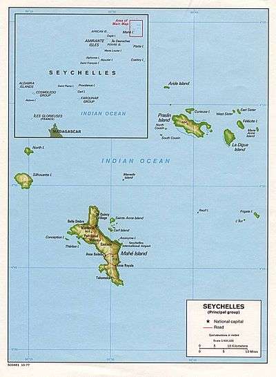
Ile aux Souris is an island in Seychelles, lying in the eastern shores of Mahe.
With a 14-metre elevation ‘it stands just inside the long line of coral reef fringing the coasts of Anse Royale and Anse Bougainville. It is rocky, about 500 metres south west of Pointe au Sel. In the vicinity you can find the Seychelles university.
The island belongs to Anse Royale District.[1]
Image gallery
 Map 1
Map 1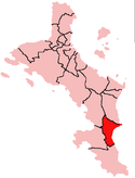 District Map
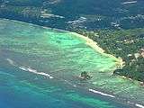 Souris Island in front of the University of Mahe
References
External links
This article is issued from
Wikipedia.
The text is licensed under Creative Commons - Attribution - Sharealike.
Additional terms may apply for the media files.