Sorenson, California
Coordinates: 37°38′44″N 122°03′57″W / 37.64556°N 122.06583°W
| Sorenson | |
|---|---|
| Unincorporated community | |
 Sorenson Location in California  Sorenson Sorenson (the US) | |
| Coordinates: 37°38′44″N 122°03′57″W / 37.64556°N 122.06583°W | |
| Country | United States |
| State | California |
| County | Alameda County |
| Elevation[1] | 79 ft (24 m) |
Sorenson is an unincorporated community in Alameda County, California. It is located on the Western Pacific Railroad 2 miles (3.2 km) south-southeast of Hayward,[2] at an elevation of 79 feet (24 m).[1] The city was named in honor of Harold Sorensen, a landowner who came to Hayward in 1881.[2]
References
External links
Municipalities and communities of Alameda County, California, United States | ||
|---|---|---|
| Cities | 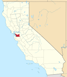 | |
| CDPs | ||
| Unincorporated communities | ||
| Former settlements | ||
This article is issued from
Wikipedia.
The text is licensed under Creative Commons - Attribution - Sharealike.
Additional terms may apply for the media files.