Carballeda de Valdeorras
| Carballeda de Valdeorras | |
|---|---|
| municipality | |
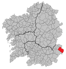 Location in Galicia | |
 Carballeda de Valdeorras Location in Spain | |
| Coordinates: 42°22′34″N 6°52′39″W / 42.37611°N 6.87750°WCoordinates: 42°22′34″N 6°52′39″W / 42.37611°N 6.87750°W | |
| Country |
|
| Autonomous community |
|
| Province |
|
| Comarca | Valdeorras |
| Government | |
| • Mayor | María Carmen González Quintela (People's Party) |
| Area[1] | |
| • Total | 222.7 km2 (86.0 sq mi) |
| Elevation | 601 m (1,972 ft) |
| Population (2016)[2] | |
| • Total | 1,664 |
| • Density | 7.5/km2 (19/sq mi) |
| Time zone | UTC+1 (CET) |
| • Summer (DST) | UTC+2 (CEST) |
| INE municipality code | 32017 |
Carballeda de Valdeorras is a larger municipality in Ourense (province) in the Galicia region of north-west Spain. It is located towards the very north-east of the province in the comarca of Valdeorras.
The only Taxus baccata forest in Galicia is located within this municipal term.
Villages
- Candeda
- Carballeda
- Casaio
- Casoio
- Domiz
- Lardeira
- A Portela do Trigal
- Pumares
- Pusmazán
- Riodolas
- Robledo
- San Xusto
- Santa Cruz
- Sobradelo
- Soutadoiro
- Vila
- Viladequinta
External links
References
- ↑ "IGE. Táboas". www.ige.eu (in Galician). Retrieved 2017-10-07.
- ↑ "IGE - Principais resultados". www.ige.eu (in Galician). Retrieved 2017-10-07.
This article is issued from
Wikipedia.
The text is licensed under Creative Commons - Attribution - Sharealike.
Additional terms may apply for the media files.