Sint-Denijs-Westrem
| Sint-Denijs-Westrem | |
|---|---|
| Deelgemeente | |
 | |
| Coordinates: 51°01′17″N 3°40′08″E / 51.02139°N 3.66889°E | |
| Country | Belgium |
| Province |
|
| Municipality | Ghent |
| Area | |
| • Total | 6.24 km2 (2.41 sq mi) |
| Population (2007) | |
| • Total | 5,134 |
| • Density | 823/km2 (2,130/sq mi) |
| Source: NIS | |
| Postal code | 9051 |
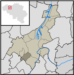
Sint-Denijs-Westrem is a village in the Belgian province of East Flanders. It is part of the city of Ghent, lying to the southwest of the city center, between Sint-Martens-Latem, De Pinte, Zwijnaarde and Afsnee.
History
Sint-Denijs-Westrem lies on the Roman road between Kortrijk and Ghent. Archeological digs on the Flanders Expo site have shown significant signs of settlement from prehistory through the middle ages.[1]
During the late Middle Ages the castles of Idewalle, Borluut, Darupt, Hof ten Broecke, Maaltekasteel were built in and around the Sint-Denijs-Westrem area.
The town square ("Gemeenteplein") was built between 1895 and 1899.
Until the 20th century the area was mainly agrarian and sparsely populated; from the second half of the 20th century on the village has been steadily more densely built up, with many castle grounds subdivided for housing development.
Notes
- ↑ Geschiedenis van Afsnee en Sint-Denijs-Westrem Accessed June 6, 2008.
External links
Coordinates: 51°1′17″N 3°40′8″E / 51.02139°N 3.66889°E