Singida Urban District
| Singida Urban District | |
|---|---|
| District | |
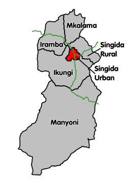 Singida Urban District's location within Singida Region. | |
| Coordinates: 04°49′S 34°45′E / 4.817°S 34.750°ECoordinates: 04°49′S 34°45′E / 4.817°S 34.750°E | |
| Country | Tanzania |
| Region | Singida Region |
| Population (2012) | |
| • Total | 150,379 |
| Area code(s) | 026 |
Singida Urban District is one of the six districts of the Singida Region of Tanzania. It is bordered to the south and west by the Ikungi District and to the north and east by the Singida Rural District. Its administrative seat is the town of Singida.
According to the 2012 Tanzania national census, the population of the Singida Urban District was 150,379.[1][2]
Transport
Paved Trunk road T3 from Morogoro to the Rwandan border passes through the district. Paved trunk road T14 connects Singida with Babati in Manyara Region.[3]
The Singida branch of the Central Line railway connects Singida with the town of Manyoni, which is on the main line.[4]
Administrative subdivisions
As of 2012, Singida Urban District was administratively divided into 16 wards.[2]
Wards
References
- ↑ Population Distribution by Administrative Areas, United Republic of Tanzania, 2013, page 123, accessed 8 November 2014 Archived 2 May 2013 at the Wayback Machine.
- 1 2 "Census 2012". National Bureau of Statistics. Archived from the original on 5 March 2016. Retrieved 16 February 2016.
- ↑ "Trunk and Regional Roads in Tanzania". Tanroads. Retrieved 1 December 2015.
- ↑ "Railways Network". Tanzania Railways Limited. Retrieved 7 March 2016.
This article is issued from
Wikipedia.
The text is licensed under Creative Commons - Attribution - Sharealike.
Additional terms may apply for the media files.