Singarayakonda
| Singarayakonda | |
|---|---|
| Census town | |
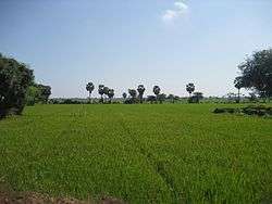 Paddy fields near Singarayakonda | |
 Singarayakonda Location in Andhra Pradesh, India | |
| Coordinates: 15°15′N 80°02′E / 15.25°N 80.03°ECoordinates: 15°15′N 80°02′E / 15.25°N 80.03°E | |
| Country | India |
| State | Andhra Pradesh |
| District | Prakasam |
| Area[1] | |
| • Total | 11.20 km2 (4.32 sq mi) |
| Elevation | 15 m (49 ft) |
| Population (2011)[2] | |
| • Total | 19,400 |
| • Density | 1,700/km2 (4,500/sq mi) |
| Languages | |
| • Official | Telugu |
| Time zone | UTC+5:30 (IST) |
| Vehicle registration | AP |
Singarayakonda is a census town in Prakasam district of the Indian state of Andhra Pradesh. It is the mandal headquarters of Singarayakonda mandal.[3]
Geography
Singarayakonda is located at 15°15′N 80°02′E / 15.25°N 80.03°E.[4] It has an average elevation of 15 metres (49 feet).
Demographics
As of 2011 India census,[5] Singarayakonda had a population of 28,675. Males constitute 48% of the population and females 52%. Singarayakonda has an average literacy rate of 68%, higher than the national average of 59.5%: male literacy is 73%, and female literacy is 61%. In Singarayakonda, 11% of the population is under 6 years of age.
Transport
Singarayakonda railway station is classified as a B–category station in the Vijayawada railway division of South Central Railway zone.[6]
singarayakonda bus station is a major diversion busstand to kandukur.the private transport like autos play major role in town.
Education
The primary and secondary school education is imparted by government, aided and private schools, under the School Education Department of the state.[7][8] The medium of instruction followed by different schools are English, Telugu.
References
- ↑ "District Census Handbook - Prakasam" (PDF). Census of India. p. 16,17,48. Retrieved 18 January 2015.
- ↑ "Census 2011". The Registrar General & Census Commissioner, India. Retrieved 25 July 2014.
- ↑ "Chittoor District Mandals" (PDF). Census of India. pp. 167, 180. Retrieved 19 June 2015.
- ↑ Falling Rain Genomics, Inc - Singarayakonda
- ↑ "Census of India 2001: Data from the 2001 Census, including cities, villages and towns (Provisional)". Census Commission of India. Archived from the original on 2004-06-16. Retrieved 2008-11-01.
- ↑ "Divisional info" (PDF). Indian Railways. Retrieved 18 July 2015.
- ↑ "School Education Department" (PDF). School Education Department, Government of Andhra Pradesh. Archived from the original (PDF) on 27 December 2015. Retrieved 7 November 2016.
- ↑ "The Department of School Education - Official AP State Government Portal | AP State Portal". www.ap.gov.in. Archived from the original on 7 November 2016. Retrieved 7 November 2016.