Silver Peak, Nevada
| Silver Peak, Nevada | |
|---|---|
| Census-designated place | |
 Albemarle Corporation (Formerly Chemetall Foote) Lithium Operation at Silver Peak | |
 Silver Peak Location within the state of Nevada | |
| Coordinates: 37°45′18″N 117°38′5″W / 37.75500°N 117.63472°WCoordinates: 37°45′18″N 117°38′5″W / 37.75500°N 117.63472°W | |
| Country | United States |
| State | Nevada |
| County | Esmeralda |
| Area | |
| • Total | 0.99 sq mi (2.56 km2) |
| • Land | 0.99 sq mi (2.56 km2) |
| • Water | 0.0 sq mi (0.0 km2) |
| Elevation | 4,321 ft (1,317 m) |
| Population (2010) | |
| • Total | 107 |
| • Density | 109/sq mi (41.9/km2) |
| Time zone | UTC-8 (Pacific (PST)) |
| • Summer (DST) | UTC-7 (PDT) |
| ZIP code | 89047 |
| FIPS code | 32-67000 |
| GNIS feature ID | 845661 |
Silver Peak (also Silverpeak) is an unincorporated community and census-designated place (CDP) in Esmeralda County, Nevada, United States. It lies along State Route 265, 20 miles (32 km) south of U.S. Route 6 and 30 miles (48 km) west of Goldfield, the county seat of Esmeralda County.[1] It has a post office, with the ZIP code of 89047.[2] The population of Silver Peak was 107 as of 2010.[3]
Economy
Silver Peak lies near a dry lake bed that is rich in lithium and other minerals.[4]
Initially, salt was mined in the area. In 1906, Spurr reported that salt was mined for local use by digging a hole a foot or two deep until water was reached and then waiting until the water evaporated. It was claimed that the salt produced in this manner was 99% pure.[5]
During World War II, Clayton Marsh was explored strategic minerals including potash and American Potash Corp. leased the marsh. In the 1950s, Leprechaun Mining (Clyde Kegel) picked up the leases and determined that in addition to potassium, lithium was present. Leprechaun Mining reached an agreement with Foote Minerals in 1964 and Foote reconfigured the silver mill and started production of lithium in 1967. In 1988, Cyprus Minerals acquired Foote and became Cyprus Foot Minerals. In 1998, Chemetall acquired the operation - the new company was called Chemetall Foote Corp. In 2004, Rockwood Holdings acquired the operation.[6] In 2010, the mine was expanded to double the capacity of its lithium carbonate production. The project was funded in part by a $28.4 million grant from the U.S. Department of Energy to expand and upgrade the production of lithium materials for advanced transportation batteries.,[7] In 2014, the Albermarle Corporation purchased Rockwood for $6.2 Billion.
As of January, 2017, the Albemarle Corporation Lithium Operation at Silver Peak[8] is currently the only operating source of lithium in the United States.[9]
The community gained some fame during California's 1999 electric power crisis. In the first major act of the power crisis causing an outage, on March 25, 1999, Enron energy traders allegedly rerouted 2,900MW (megawatts) of electricity destined for California to this small Nevada community. This caused a large shortage on the California power grid because the largest power feeder (intertie) from this area to California had a capacity of 15MW (about 0.5% of the required wheeling capacity).[10]
News accounts claim this single action created an estimated $7 million of revenue for Enron. The company was fined $25,000 for their action, suggesting to some that this was a viable way for the firm to make money.
History
Silver Peak is one of the oldest mining communities in Nevada. It was founded near a well in 1864,[11] two years after the founding of surrounding Esmeralda County, and one year after silver was discovered nearby and mining began.[12] A 10 stamp mill was built in 1865, and a 20 stamp mill by 1867. The Silver Peak Railroad was built by the Pittsburgh Silver Peak Gold Mining Company after it bought a group of mining properties in 1906 and established a 100 stamp mill at Blair, Nevada, in 1907. Blair's mill closed in 1915, and Blair was a ghost town by 1920.[13] Silver Peak maintained a population, however, even though it burned in 1948.[14]
In 1939, boxer Max Baer defeated "Big Ed" Murphy of Silver Peak in one round in a fight at Silver Peak.[15]
References
- ↑ Rand McNally. The Road Atlas '08. Chicago: Rand McNally, 2008, p. 64.
- ↑ Zip Code Lookup
- ↑ "Geographic Identifiers: 2010 Demographic Profile Data (G001): Silver Peak CDP, Nevada". U.S. Census Bureau, American Factfinder. Retrieved February 16, 2016.
- ↑ Robinson, Paul T. (1972). "Petrology of the Potassic Silver Peak Volcanic Center, Western Nevada" (PDF). Geological Society of America Bulletin. 83 (6): 1693. doi:10.1130/0016-7606(1972)83[1693:POTPSP]2.0.CO;2. ISSN 0016-7606.
- ↑ Spurr, Josiah Edward (1906). Ore Deposits of the Silver Peak Quadrangle, Nevada (Report). U.S. Government Printing Office. p. 159. Retrieved December 31, 2017.
- ↑ Kogel, Jessica Elzea (2006). Industrial Minerals & Rocks: Commodities, Markets, and Uses. p. 605. Retrieved December 29, 2017.
- ↑ "Expansion of Chemetall Foote lithium operation in Nevada". July 12, 2010. Archived from the original on July 8, 2011.
- ↑ "Global Supplier of Specialty Chemicals, Social and Environmental Issues, Albemarle". Albemarle Corporation. Retrieved December 28, 2017.
- ↑ "Mineral Commodity Summaries" (PDF). United States Geological Survey. January 2017. Retrieved December 28, 2017.
- ↑ Ernst ten Heuvelhof (2009). "Strategic Behaviour in Network Industries: A Multidisciplinary Approach". Cheltenham: Edward Elgar. ISBN 978-1-84720-610-7.
- ↑ Esmeralda County's page on Silver Peak Archived 2011-03-09 at the Library of Congress Web Archives
- ↑ Silver Peak page at Ghosttowns.com
- ↑ Blair page at Ghosttowns.com
- ↑ "Silver Peak (Discovered 1863), Nevada Historical Marker 155". Nevada Division of Water Planning, Nevada Historical Markers Index. Archived from the original on 29 Sep 2006.
- ↑ Shamberger, Hugh A. (1976). The Story of Silver Peak, Esmeralda County, Nevada. Nevada Historical Press. pp. 111 pages. Retrieved January 9, 2018.
Further reading
- Ford, Victoria (ed.), "Silver Peak: At Work, At Play, and At Home," University of Nevada, Reno, 2000. archive.org
- Ford, Victoria, "Silver Peak: Never A Ghost Town," University of Nevada, Reno, 2002. archive.org
External links
| Wikimedia Commons has media related to Silver Peak (Esmeralda County, Nevada). |
- Photograph of the Black Mammoth Consolidated Mining Company's commissary, Mary Mine (Nev.), circa 1937 (University of Las Vegas)
- Photograph of Silver Peak, Nevada; Title taken from image; postcard ca. 1925-1935 (University of Nevada, Reno)
Municipalities and communities of Esmeralda County, Nevada, United States | ||
|---|---|---|
| CDPs | 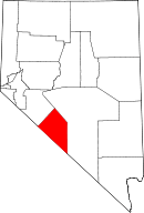 | |
| Ghost towns | ||