Shipley, Oregon
| Shipley, Oregon | |
|---|---|
| Unincorporated community | |
 Sawmill in Shipley | |
 Shipley, Oregon Location within the state of Oregon  Shipley, Oregon Shipley, Oregon (the US) | |
| Coordinates: 45°5′45″N 123°25′58″W / 45.09583°N 123.43278°WCoordinates: 45°5′45″N 123°25′58″W / 45.09583°N 123.43278°W | |
| Country | United States |
| State | Oregon |
| County | Yamhill |
| Time zone | UTC-8 (Pacific (PST)) |
| • Summer (DST) | UTC-7 (PDT) |
| GNIS feature ID | 1163268[1] |
Shipley, Oregon is an unincorporated community in Yamhill County, Oregon, United States. Most of the area has been annexed by the city of Sheridan.
Location
Shipley is located at the intersection of Oregon Route 18 Business and Rock Creek Road on the western end of Sheridan. Rock Creek road travels to the Delphi Schools. Willamina is located to the west. It sits at 213 feet above sea level in the Yamhill Valley along the South Yamhill River.[1] The ZIP Code for Shipley is 97378.[2]
References
- 1 2 "Shipley". Geographic Names Information System. United States Geological Survey.
- ↑ Shipley, Oregon Information. BigDaddyData. Retrieved on February 28, 2008.
Municipalities and communities of Yamhill County, Oregon, United States | ||
|---|---|---|
| Cities | 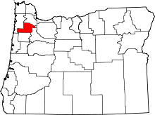 | |
| CDPs | ||
| Other unincorporated communities | ||
| Indian reservation | ||
| Footnotes | ‡This populated place also has portions in an adjacent county or counties | |
This article is issued from
Wikipedia.
The text is licensed under Creative Commons - Attribution - Sharealike.
Additional terms may apply for the media files.